Earth
ID: 12159
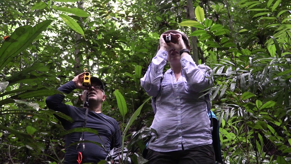
NASA researchers have their boots on the ground and wings in the skies in Gabon, on Africa¹s west coast, for a comprehensive survey of the carbon storage of tropical forests. Partnering together with the European Space Agency, the German space agency (DLR), and Gabon's young space agency (AGEOS), NASA is studying rain forests and mangrove forests using both the Land, Vegetation, and Ice Sensor (LVIS) laser altimeter instrument and the Uninhabited Aerial Vehicle Synthetic Aperture Radar (UAVSAR). During the AfriSAR campaign, UAVSAR will fly at 40,000 feet high mounted beneath a C-20A aircraft from NASA¹s Armstrong Flight Research Center, Edwards, California, while LVIS will fly at 28,000 feet onboard a B-200 airplane from NASA¹s Langley Research Center in Hampton, Virginia. For more information, go to: https://www.nasa.gov/feature/goddard/2016/nasa-partner-space-agencies-measure-forests-in-gabon
AfriSAR, an Introduction: The Carbon in the Trees
Credits
Jefferson Beck (USRA): Lead Producer
Temilola Fatoyinbo (NASA/GSFC): Lead Scientist
Lori A. Losey (Arcata): Lead Videographer
Chris Smith (Self): Animator
Temilola Fatoyinbo (NASA/GSFC): Lead Scientist
Lori A. Losey (Arcata): Lead Videographer
Chris Smith (Self): Animator
Please give credit for this item to:
NASA's Goddard Space Flight Center
NASA's Goddard Space Flight Center
Short URL to share this page:
https://svs.gsfc.nasa.gov/12159
This item is part of this series:
Narrated Movies
Keywords:
SVS >> Carbon Cycle
SVS >> HDTV
SVS >> Laser Altimeter
GCMD >> Location >> Gabon
NASA Science >> Earth
GCMD keywords can be found on the Internet with the following citation: Olsen, L.M., G. Major, K. Shein, J. Scialdone, S. Ritz, T. Stevens, M. Morahan, A. Aleman, R. Vogel, S. Leicester, H. Weir, M. Meaux, S. Grebas, C.Solomon, M. Holland, T. Northcutt, R. A. Restrepo, R. Bilodeau, 2013. NASA/Global Change Master Directory (GCMD) Earth Science Keywords. Version 8.0.0.0.0


