Earth
ID: 11920

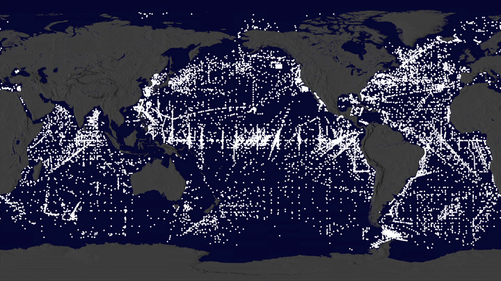
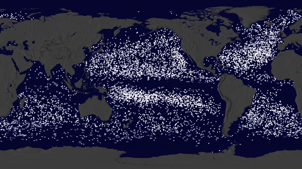
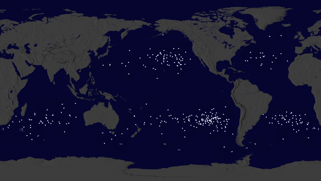
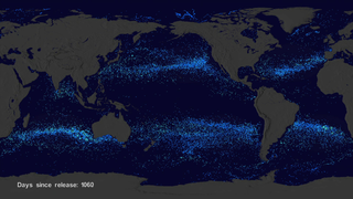
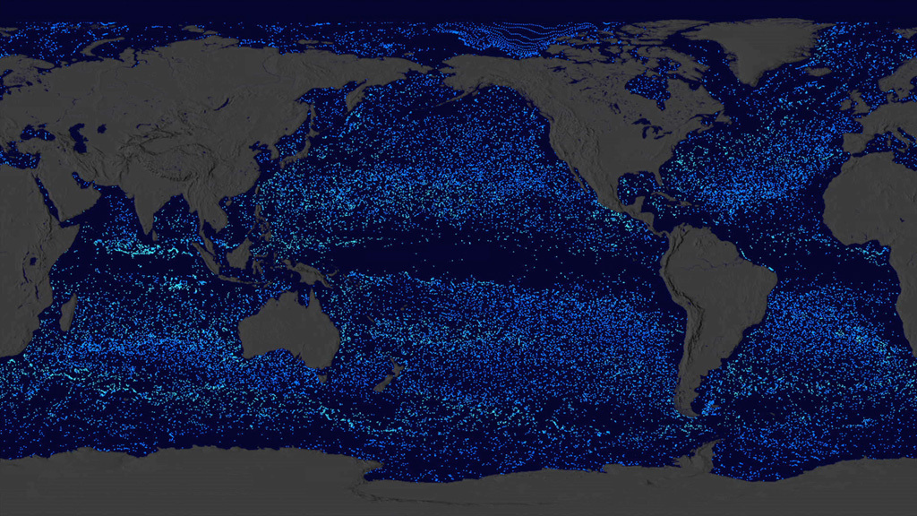
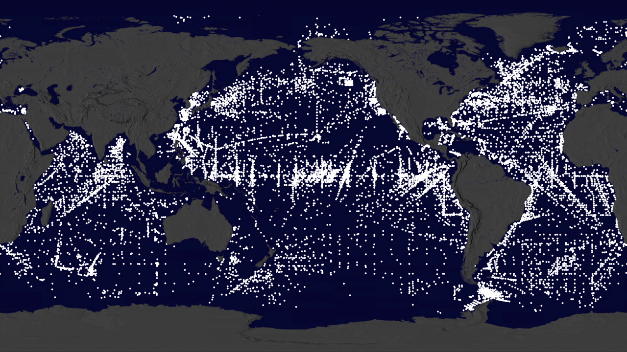
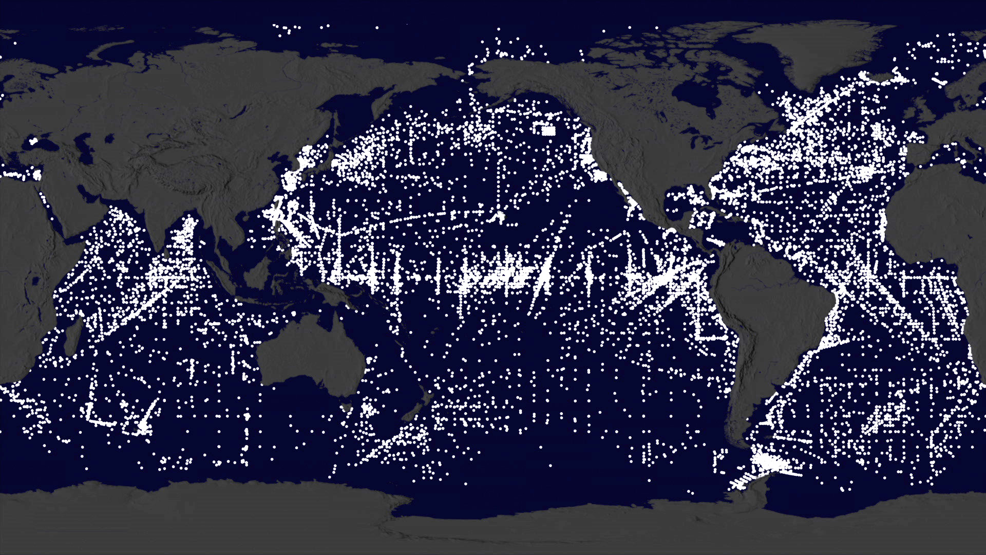
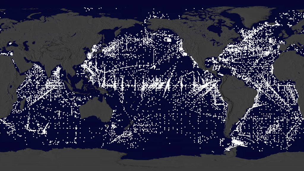
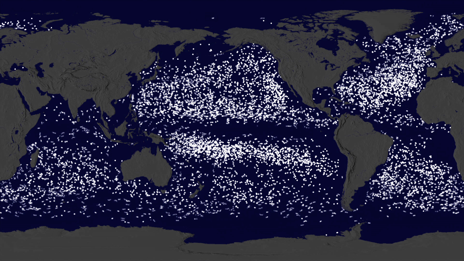
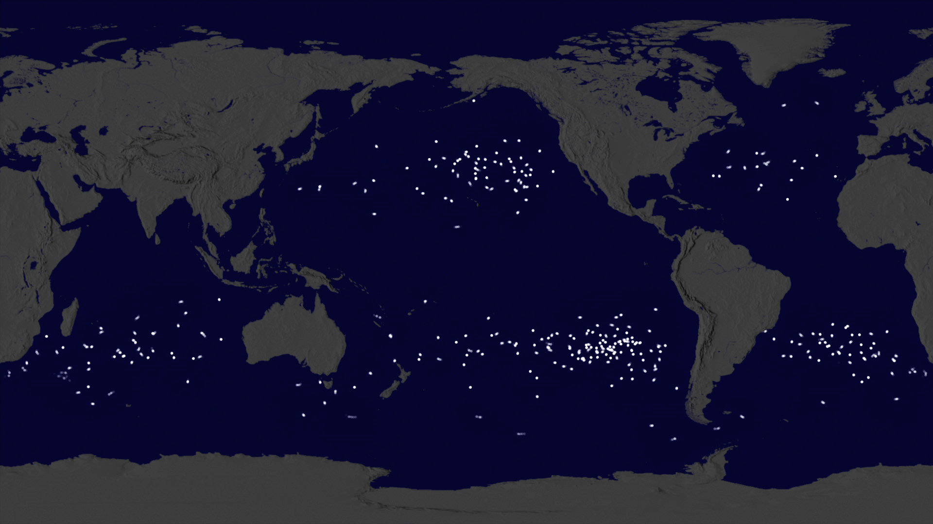
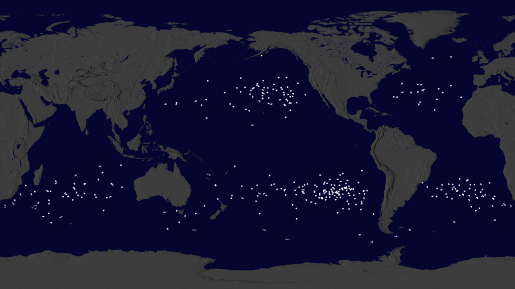
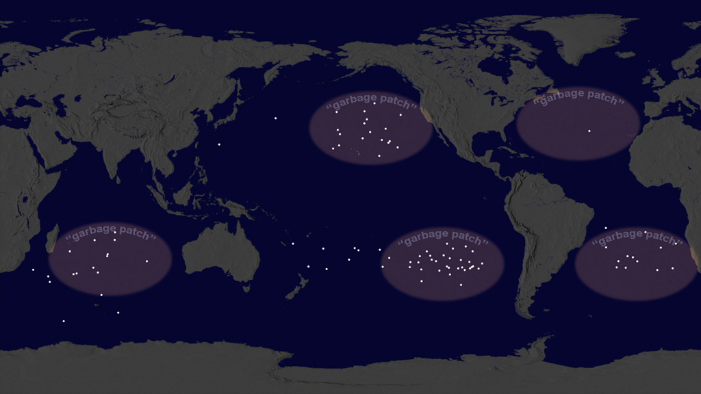
When a research buoy is released in the ocean, where does it go? In a visualization experiment using ocean buoy data from NOAA's Global Drifter Database, NASA data visualizers depicted the migration of these floating science platforms in Earth's oceans. Over the last 35 years, NOAA has deployed thousands of ocean buoys worldwide. The buoys travel with currents, collecting important measurements of ocean properties like temperature and salinity that scientists use for weather forecasting and verifying observations from Earth-observing satellites. In the visualization, the buoys are seen migratating over time to five known gyres in the ocean where marine debris accumulates, the so-called ocean garbage patches. The visualizers used a computational model of Earth's ocean currents and virtual particles to confirm the result. Watch the video to learn more.

Drifting At Sea
Related Story
Story Credits
Lead Visualizers/Animators:
Greg Shirah (NASA/GSFC)
Horace Mitchell (NASA/GSFC)
Project Support:
Leann Johnson (Global Science and Technology, Inc.)
Laurence Schuler (ADNET Systems, Inc.)
Ian Jones (ADNET Systems, Inc.)
Lead Writer:
Greg Shirah (NASA/GSFC)
Greg Shirah (NASA/GSFC)
Horace Mitchell (NASA/GSFC)
Project Support:
Leann Johnson (Global Science and Technology, Inc.)
Laurence Schuler (ADNET Systems, Inc.)
Ian Jones (ADNET Systems, Inc.)
Lead Writer:
Greg Shirah (NASA/GSFC)
Please give credit for this item to:
NASA's Scientific Visualization Studio
NASA's Scientific Visualization Studio
Short URL to share this page:
https://svs.gsfc.nasa.gov/11920
Keywords:
SVS >> App
NASA Science >> Earth
https://svs.gsfc.nasa.gov/11920
Keywords:
SVS >> App
NASA Science >> Earth


