Earth
ID: 11590
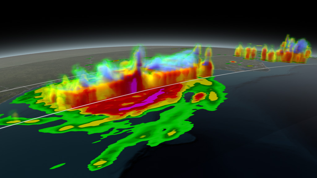
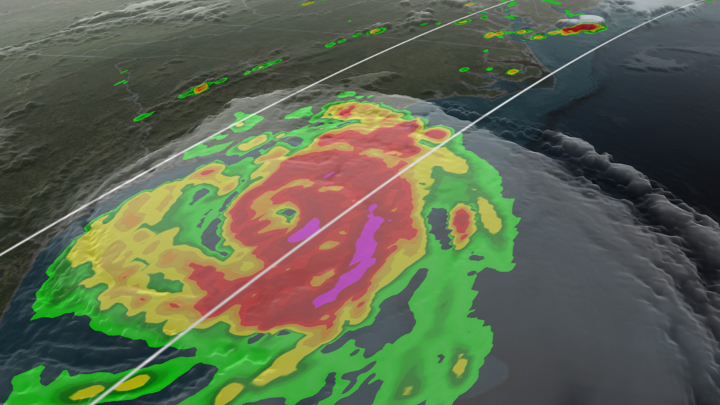
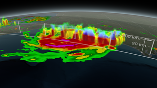
Hurricane Arthur became the first storm of the 2014 Atlantic hurricane season. The storm formed on June 30 off the coast of Florida and was classified as a Category 2 hurricane when it made landfall over North Carolina on July 3. That morning, NASA’s Global Precipitation Measurement (GPM) Core Observatory satellite passed over the hurricane, detecting the drops of water that descended from its winding clouds. The satellite, which launched in February 2014, has two instruments that measure the location and intensity of water falling from inside a storm. Such observations help scientists distinguish the structure of features that power a hurricane, providing clues as to whether or not a storm will strengthen. Watch the video to see a 2D and 3D visualization of Arthur's precipitation as the hurricane approached shore.


Seeing Inside A Storm
Related Story
For More Information
Story Credits
Visualizers/Animators:
Alex Kekesi (Global Science and Technology, Inc.)
Greg Shirah (NASA/GSFC)
Producers:
Ryan Fitzgibbons (USRA)
Rani Gran (NASA/GSFC)
Lead Scientists:
Gail Skofronick Jackson (NASA/GSFC)
George Huffman (NASA/GSFC)
Dalia B Kirschbaum (NASA/GSFC)
Project Support:
Laurence Schuler (ADNET Systems, Inc.)
Ian Jones (ADNET Systems, Inc.)
Chris Kidd (University of Maryland)
John M. Kwiatkowski (George Mason University)
William S. Olson (JCET/UMBC)
Lead Writer:
Ellen T. Gray (ADNET Systems, Inc.)
Please give credit for this item to:
NASA's Goddard Space Flight Center
Satellite images courtesy of NASA/GSFC/MODIS Rapid Response Team
NASA's Goddard Space Flight Center
Satellite images courtesy of NASA/GSFC/MODIS Rapid Response Team
Short URL to share this page:
https://svs.gsfc.nasa.gov/11590
Keywords:
SVS >> App
NASA Science >> Earth
https://svs.gsfc.nasa.gov/11590
Keywords:
SVS >> App
NASA Science >> Earth


