Earth
ID: 11475
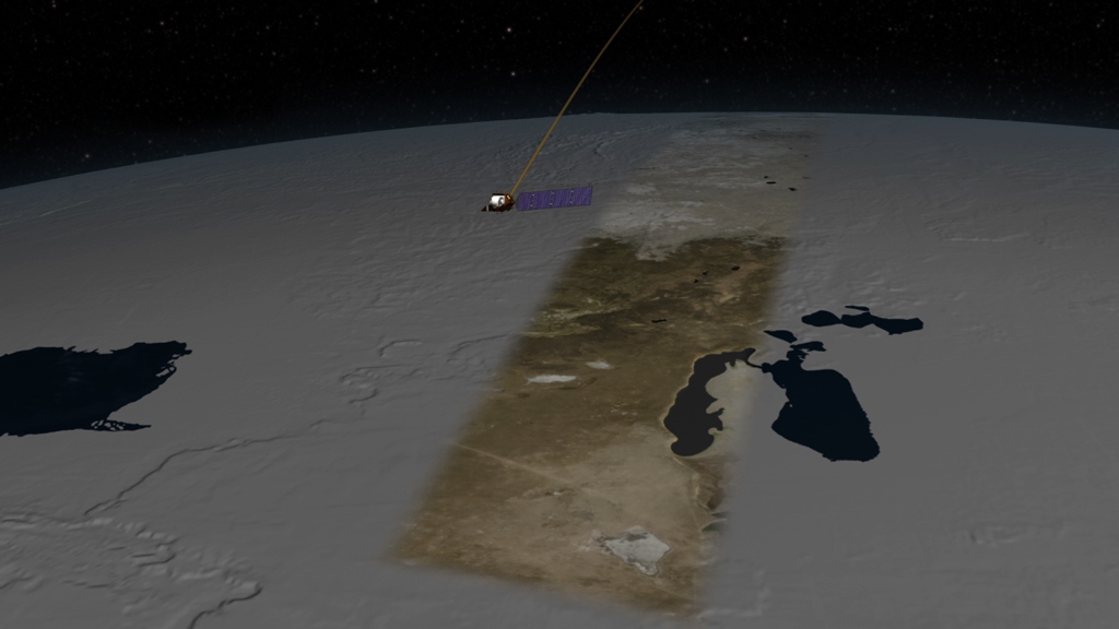
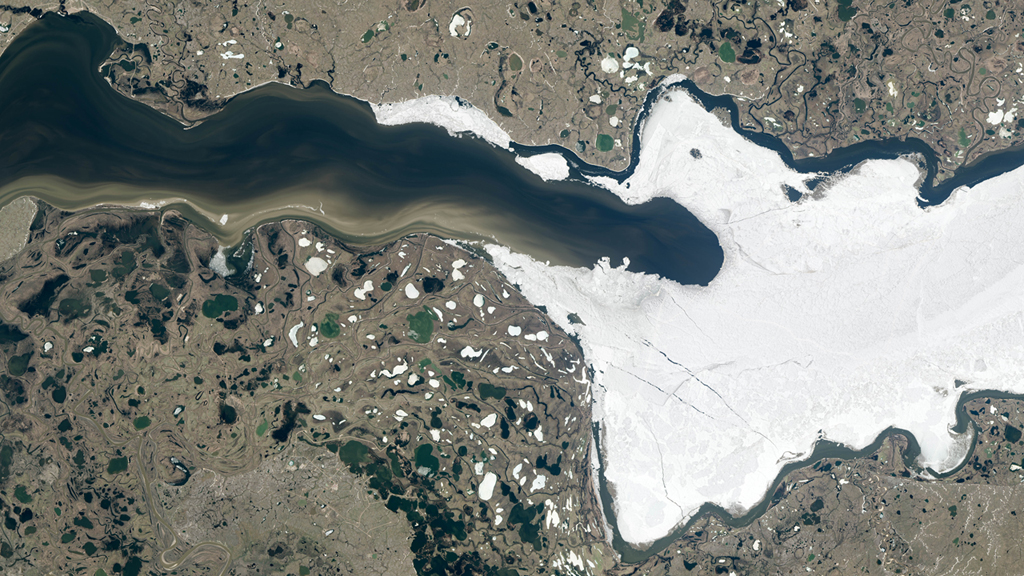
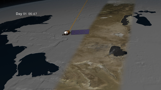
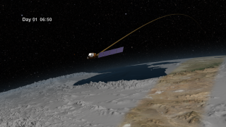
Since its launch in February 2013, the Landsat 8 satellite has collected detailed views of Earth’s surface. The satellite images a continuous strip of land 115 miles across, or about the width of Florida’s peninsula, as it circles the poles. As the planet rotates, the view beneath the satellite’s detector shifts, allowing it to glimpse a new parade of forests, farmland, cities, glaciers and more. The satellite gathers data on roughly half of Earth’s surface every eight days, and the entire planet every 16 days. Landsat 8 is a joint NASA and U.S. Geological Survey mission, and is the latest in the Landsat series of Earth-observing satellites that have continuously monitored land cover for more than four decades. Watch the video to learn more.


Earth Mapper
Related Stories
For More Information
Story Credits
Visualizers/Animators:
Cindy Starr (Global Science and Technology, Inc.)
Greg Shirah (NASA/GSFC)
Ernie Wright (USRA)
Walt Feimer (HTSI)
Rachel Kreutzinger (USRA)
Video Editor:
Matthew R. Radcliff (USRA)
Interviewee:
James R. Irons (NASA/GSFC)
Narrator:
James R. Irons (NASA/GSFC)
Producer:
Matthew R. Radcliff (USRA)
Lead Scientist:
James R. Irons (NASA/GSFC)
Lead Writer:
Kate Ramsayer (Telophase)
Please give credit for this item to:
NASA's Goddard Space Flight Center
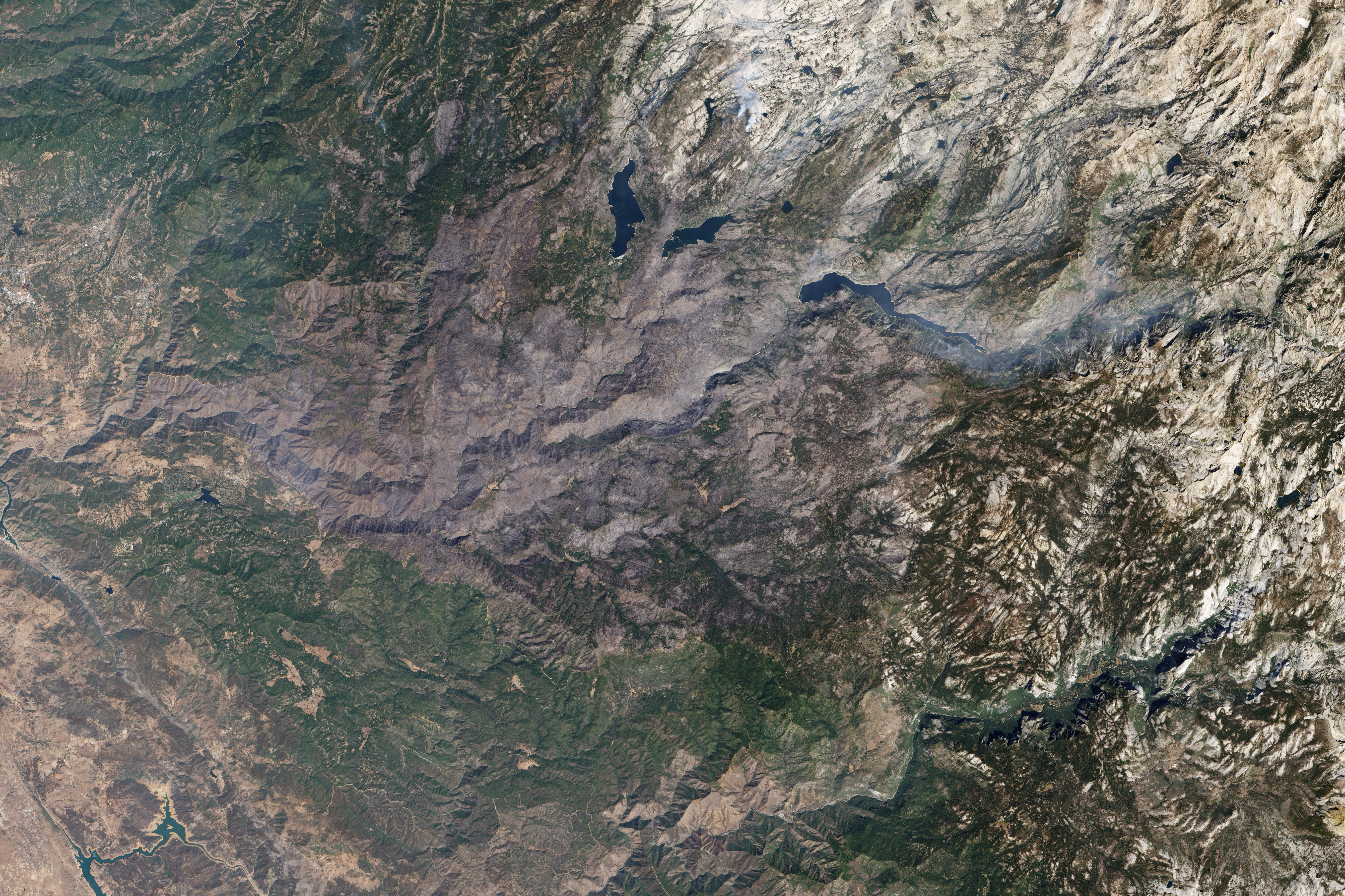
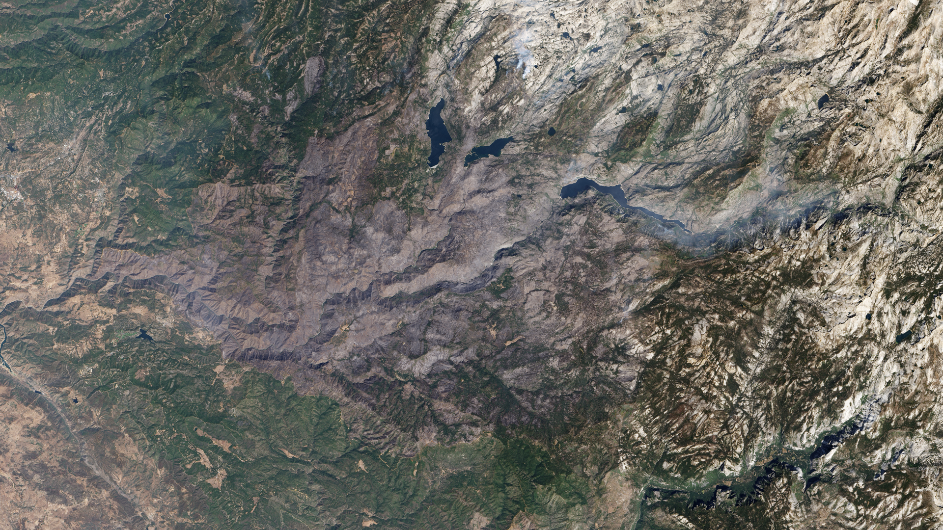
Yosemite image courtesy of NASA Earth Observatory/Robert Simmon
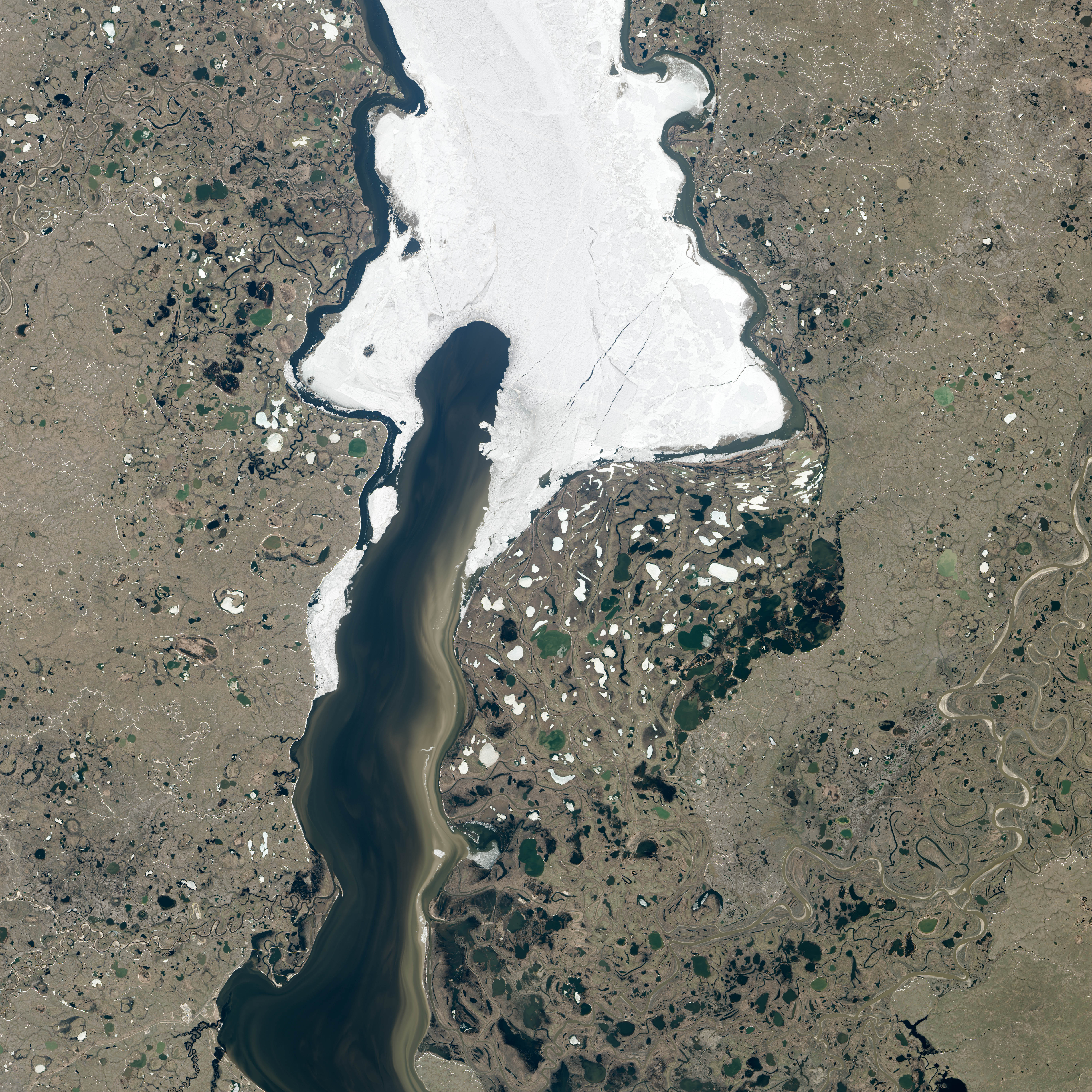
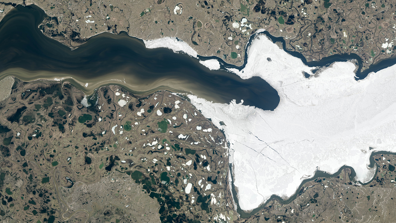
Taz River image courtesy of NASA Earth Observatory/Jesse Allen and Robert Simmon
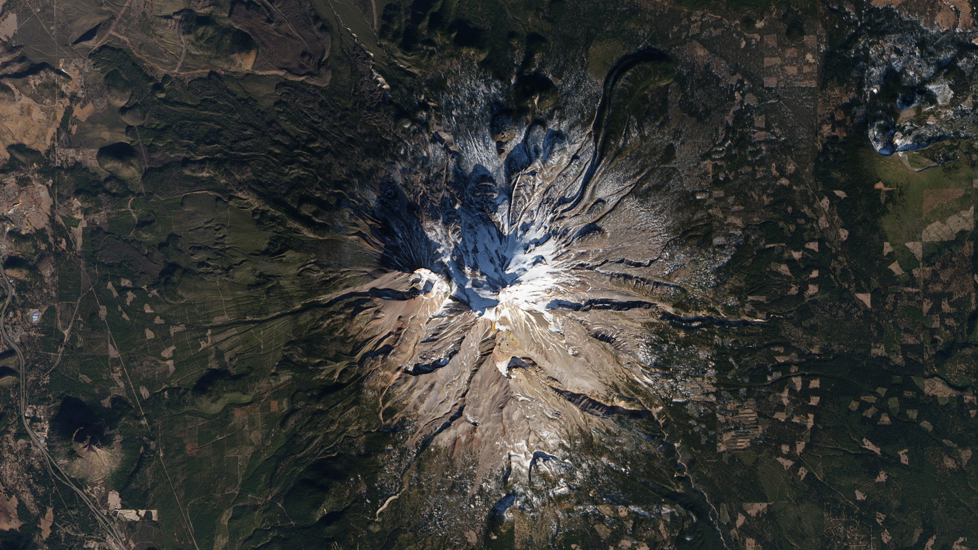
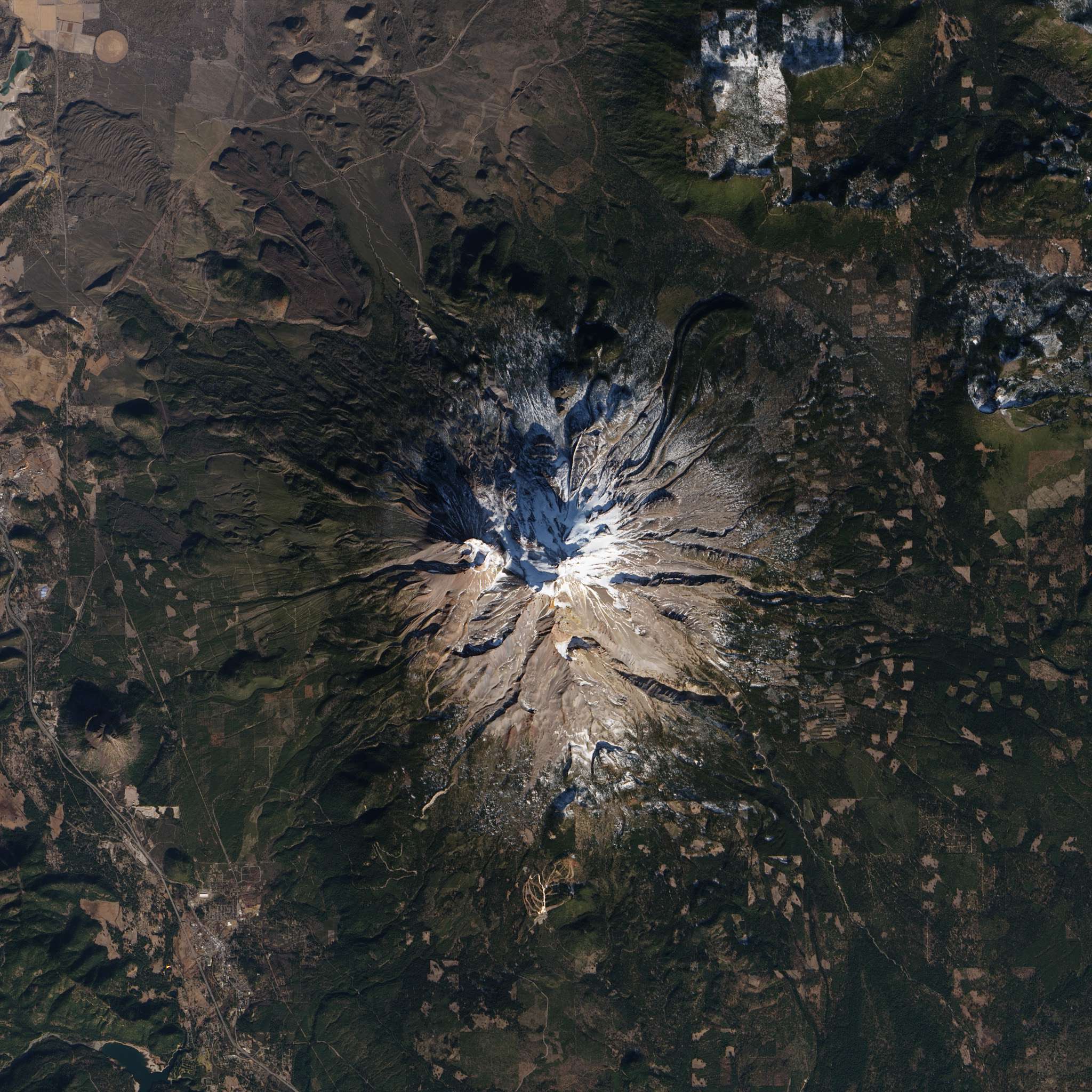
Mount Shasta image courtesy of NASA Earth Observatory/Robert Simmon
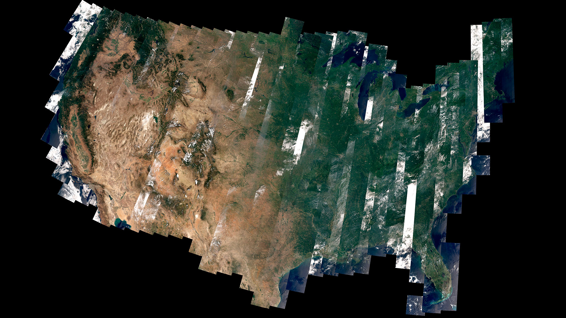
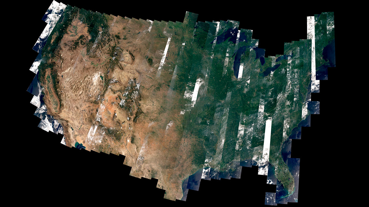
United States image courtesy of USGS/NASA/WELD/David Roy
NASA's Goddard Space Flight Center
Yosemite image courtesy of NASA Earth Observatory/Robert Simmon
Taz River image courtesy of NASA Earth Observatory/Jesse Allen and Robert Simmon
Mount Shasta image courtesy of NASA Earth Observatory/Robert Simmon
United States image courtesy of USGS/NASA/WELD/David Roy
Short URL to share this page:
https://svs.gsfc.nasa.gov/11475
Keywords:
DLESE >> Narrated
SVS >> App
NASA Science >> Earth
https://svs.gsfc.nasa.gov/11475
Keywords:
DLESE >> Narrated
SVS >> App
NASA Science >> Earth


