Earth
ID: 11350
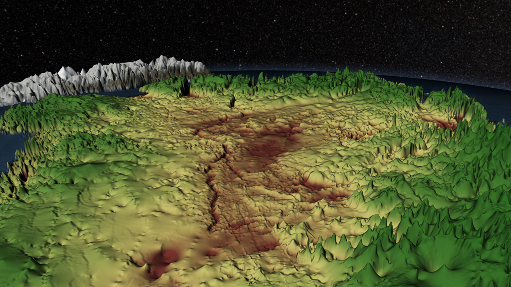
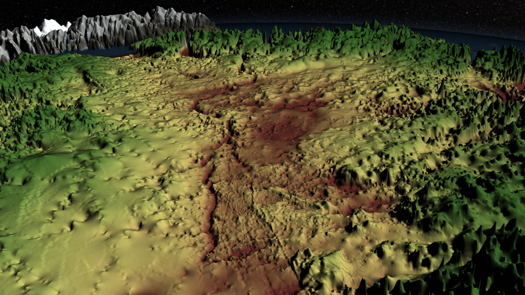
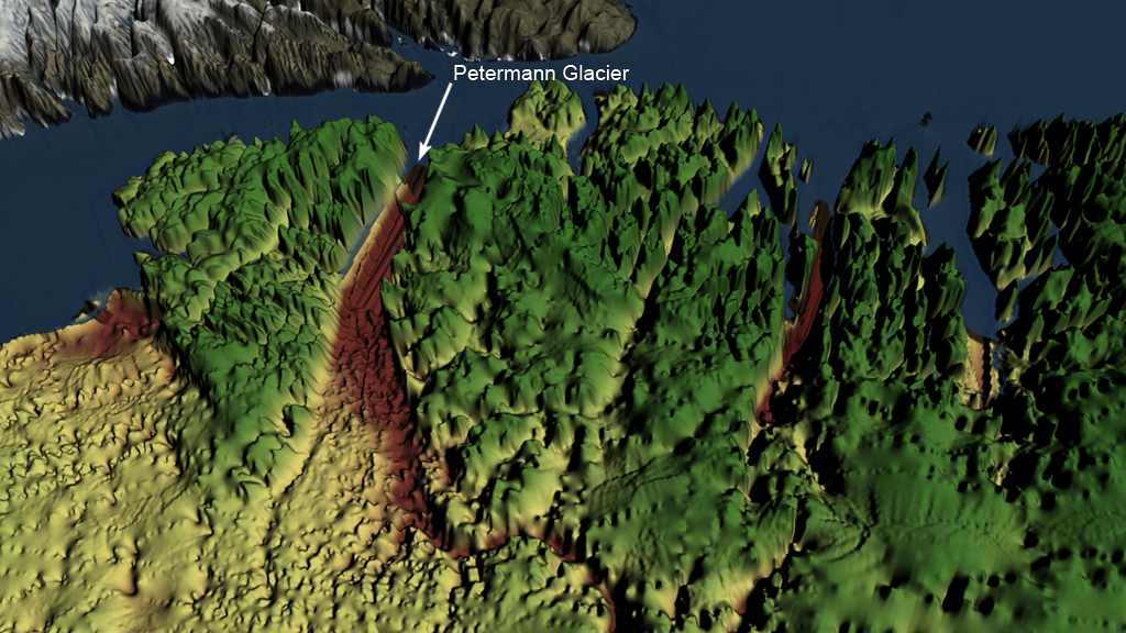
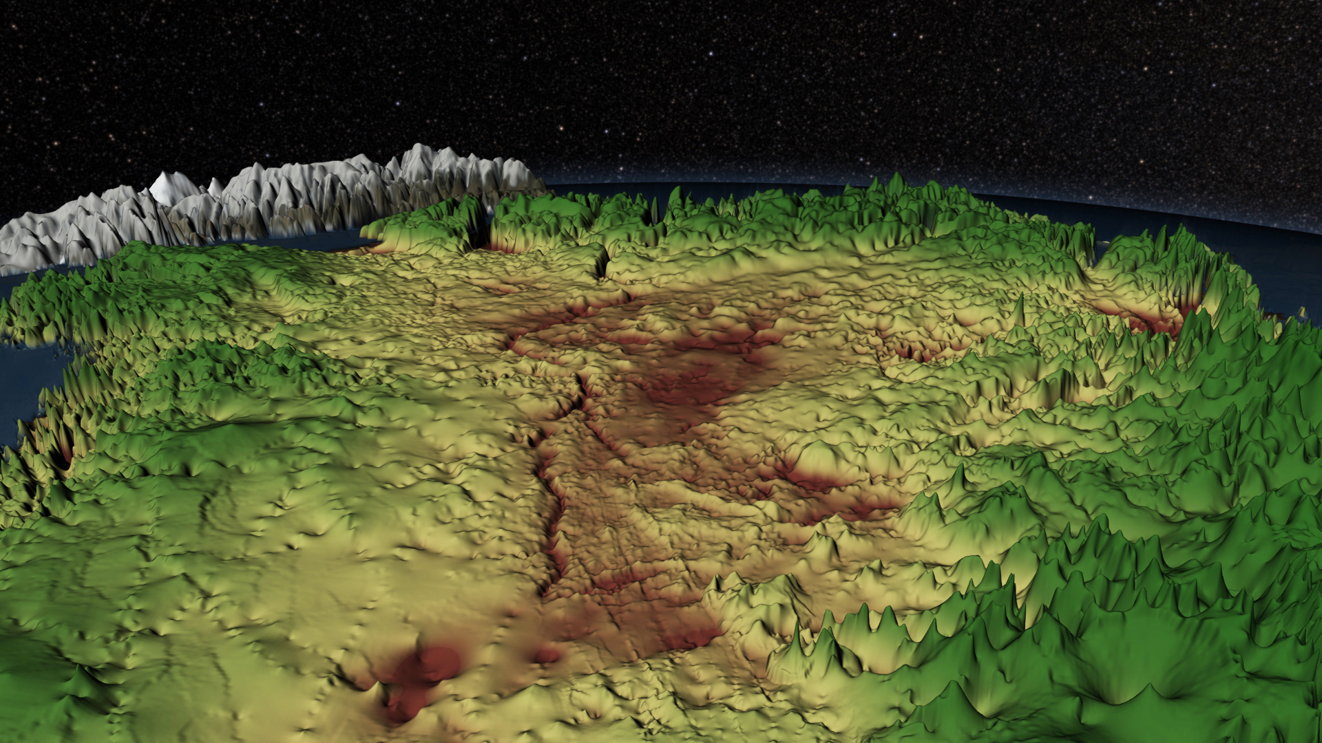
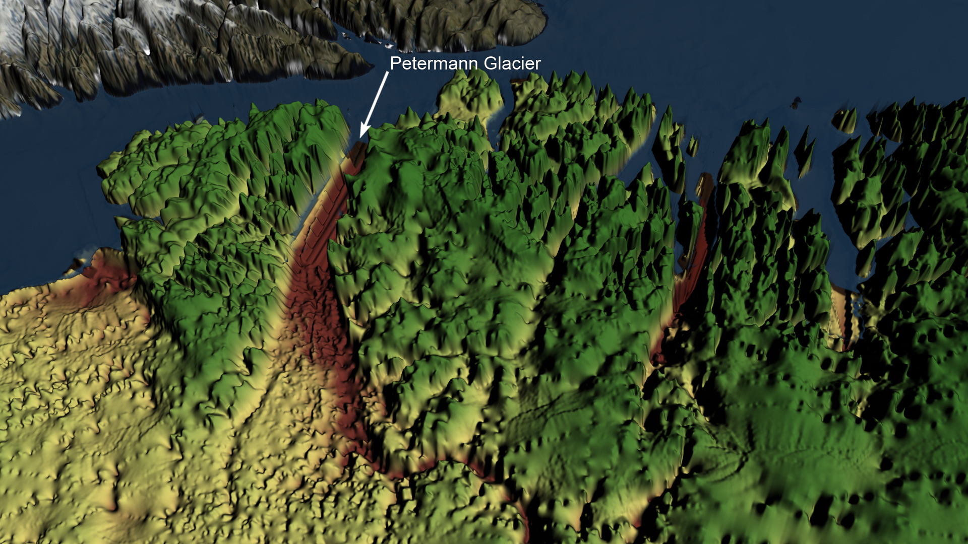
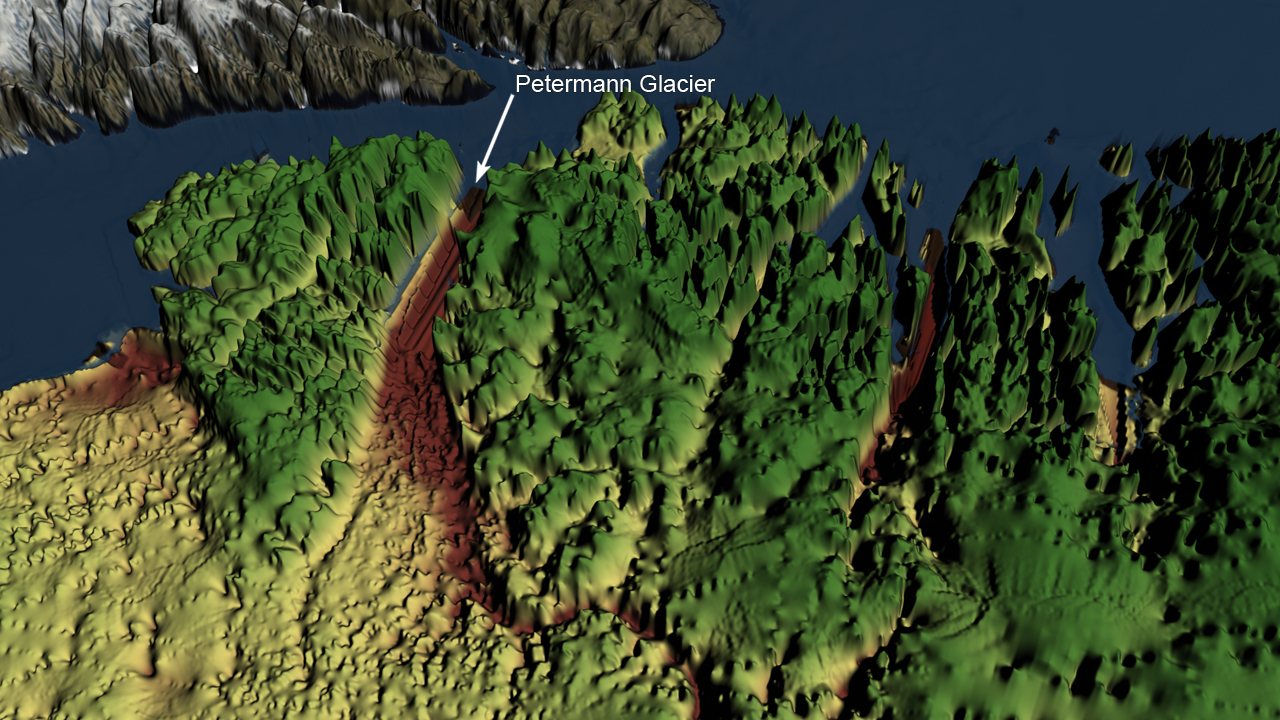
Ice has blanketed Greenland for millions of years. In some places it can be almost two miles thick. Scientists now know that hidden beneath the ice is a canyon that extends hundreds of miles north from near the center of the ice sheet. By combining more than four years’ worth of ice-penetrating radar measurements from NASA’s Operation IceBridge mission with other data sets, researchers created a topographic map of Greenland’s bedrock. The map shed light on the existence of a canyon that measures at least 460 miles in length and a half-mile deep. At greater than 1.5 times the length of the Grand Canyon, it is longer than any known canyon on Earth. Watch the visualization for a tour of Greenland’s massive, under-ice canyon. In the visualization the terrain elevation is shown using color, where greens indicate areas above sea level, browns indicate areas below sea level, and yellows indicate areas at or near sea level.
Megacanyon
Related Story

For More Information
Story Credits
Visualizers/Animators:
Cindy Starr (Global Science and Technology, Inc.)
Greg Shirah (NASA/GSFC)
Producer:
Jefferson Beck (USRA)
Lead Scientists:
J. L. Bamber (School of Geographical Sciences, University of Bristol, UK)
Michael Studinger (NASA/GSFC)
Lead Writer:
Kayvon Sharghi (USRA)
Cindy Starr (Global Science and Technology, Inc.)
Greg Shirah (NASA/GSFC)
Producer:
Jefferson Beck (USRA)
Lead Scientists:
J. L. Bamber (School of Geographical Sciences, University of Bristol, UK)
Michael Studinger (NASA/GSFC)
Lead Writer:
Kayvon Sharghi (USRA)
Please give credit for this item to:
NASA's Goddard Space Flight Center
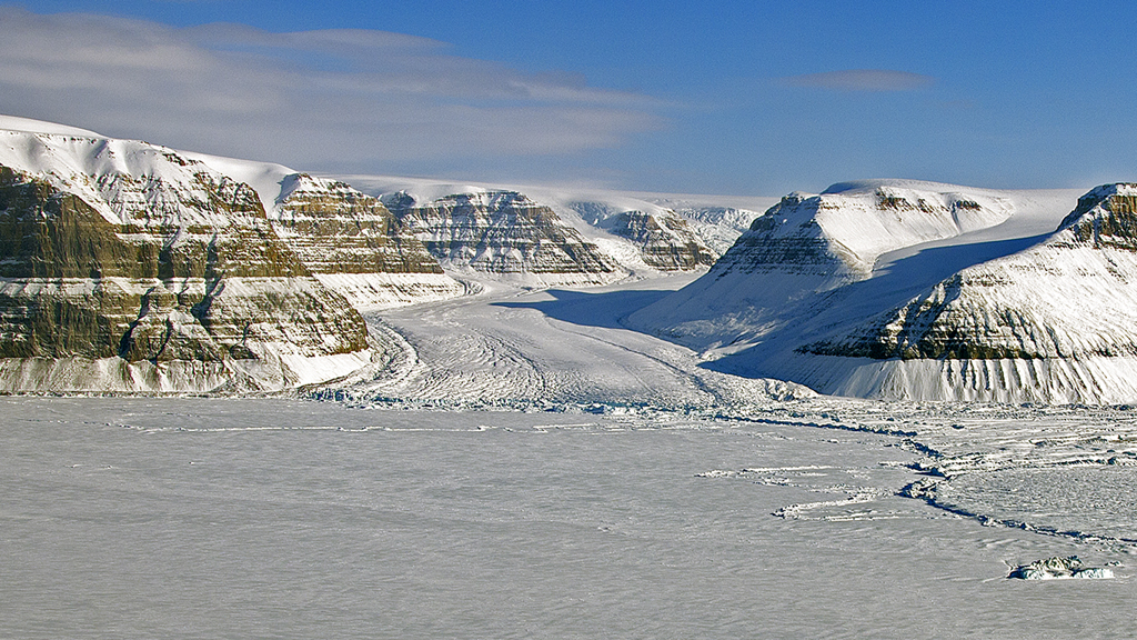
Petermann Glacier image courtesy of NASA/M. Studinger
NASA's Goddard Space Flight Center
Petermann Glacier image courtesy of NASA/M. Studinger
Short URL to share this page:
https://svs.gsfc.nasa.gov/11350
Keywords:
SVS >> App
NASA Science >> Earth
https://svs.gsfc.nasa.gov/11350
Keywords:
SVS >> App
NASA Science >> Earth


