Earth
ID: 11282

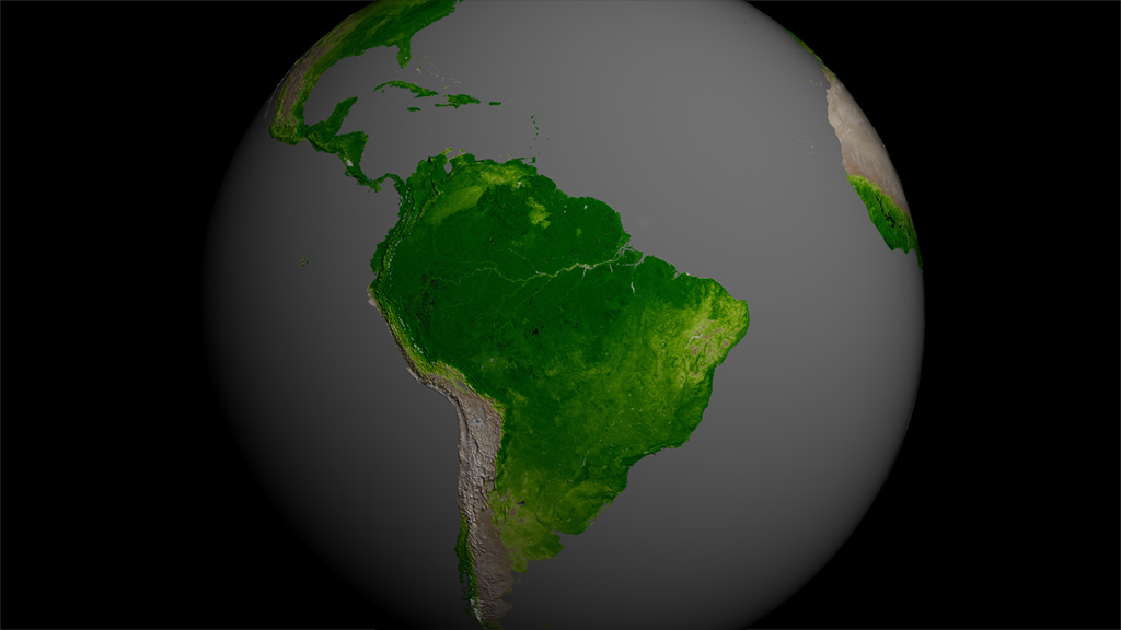
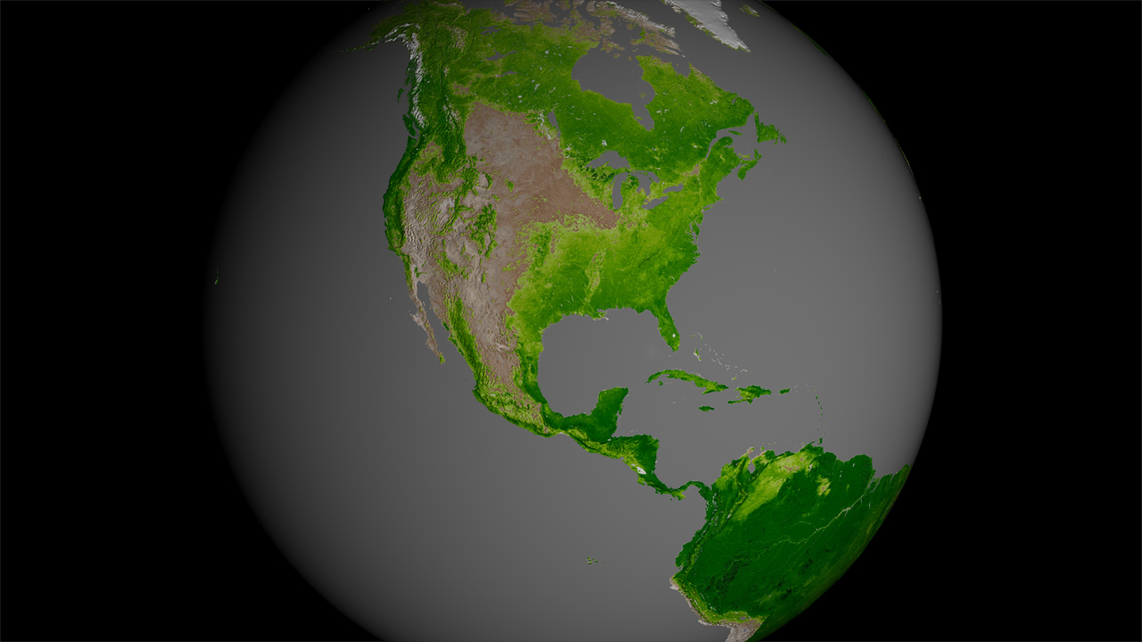
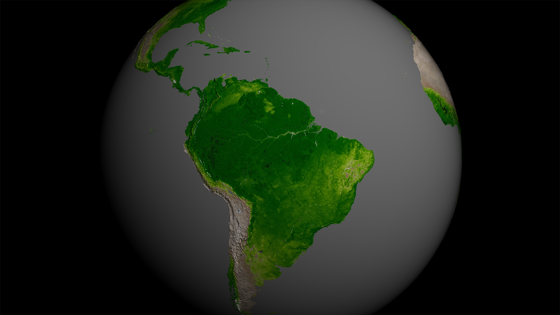
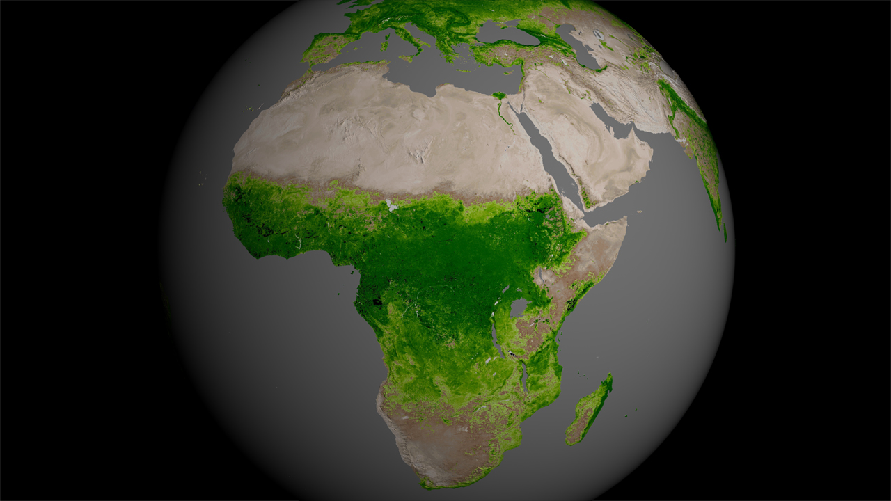
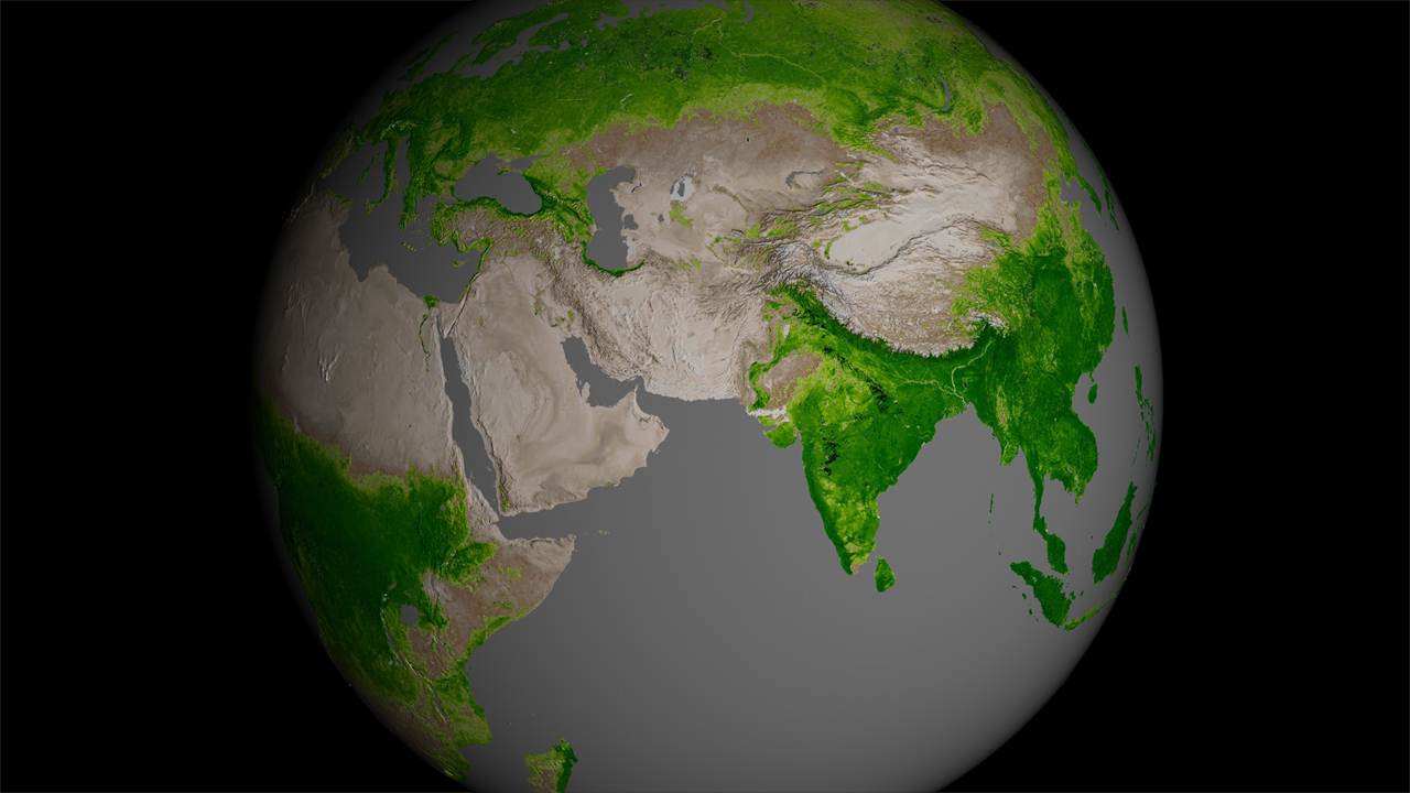
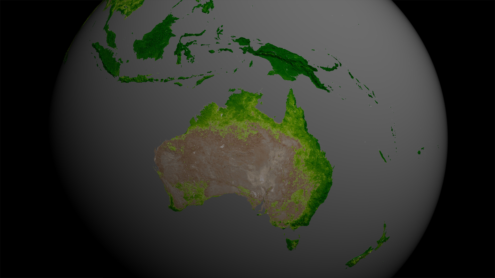
Across the continents, plants flourish or flounder depending on climate, precipitation and human activities. By using advanced satellite sensors that can detect the greenness of plants from space, scientists have amassed a decades-long record of the planet's terrestrial plant life. Data from the NASA/NOAA Suomi NPP satellite, the latest to make these measurements, was used to produce detailed images of plant activity around the world. The dense green areas on the globe represent thriving flora, whereas the light green or tan areas represent sparse plant life or struggling vegetation. The data will be incorporated into U.S. weather prediction models and could help provide early warnings of droughts and fires. Watch the visualization to see how Earth’s plant life changes over the course of a year.


Far-out Flora
For More Information
Story Credits
Visualizer/Animator:
Lori Perkins (NASA/GSFC)
Video Editor:
Kayvon Sharghi (USRA)
Lead Scientists:
Eric Vermote (NASA/GSFC)
James Gleason (NASA/GSFC)
Lead Writer:
Kasha Patel (NASA/GSFC)
Lori Perkins (NASA/GSFC)
Video Editor:
Kayvon Sharghi (USRA)
Lead Scientists:
Eric Vermote (NASA/GSFC)
James Gleason (NASA/GSFC)
Lead Writer:
Kasha Patel (NASA/GSFC)
Please give credit for this item to:
NASA's Goddard Space Flight Center
NASA's Goddard Space Flight Center
Short URL to share this page:
https://svs.gsfc.nasa.gov/11282
Keywords:
SVS >> App
NASA Science >> Earth
https://svs.gsfc.nasa.gov/11282
Keywords:
SVS >> App
NASA Science >> Earth


