Earth
ID: 11249
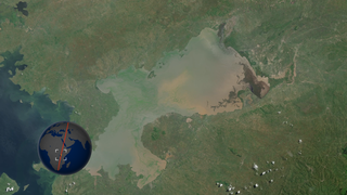
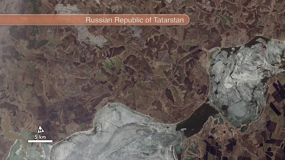
After two months of on-orbit testing and calibration, Landsat 8 (previously called LDCM) fired its propulsion system on April 12, 2013, and ascended to its final orbit 438 miles (705 km) above Earth. The animation, made from scenes taken a week later on April 19, allows viewers to fly with the satellite from its final operating orbit. 56 continuous Landsat scenes from that orbit have been stitched together into a seamless view from Russia to South Africa. Orbiting at 16,800 mph (27,000 kph), Landsat 8 made this flight in just more than 20 minutes. The animation moves faster, covering 5,665 miles (9,117 kilometers) in nearly 16 minutes. You would have to be moving about 21,930 mph (35,290 kph) to get a similar view — only slightly slower than the Apollo astronauts who entered Earth's orbit from the moon at 25,000 mph (40,200 kph).
Landsat 8 Long Swath
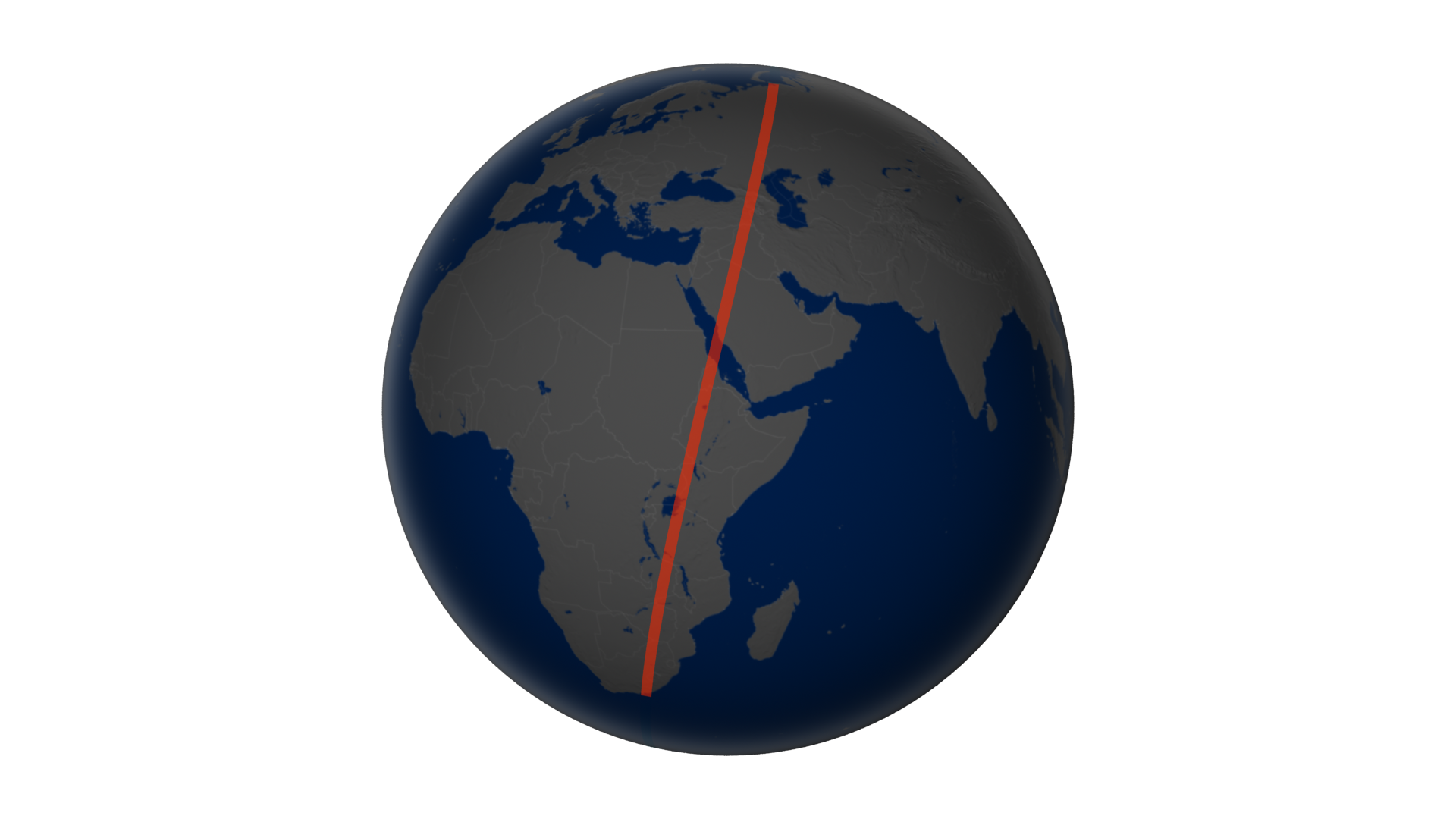
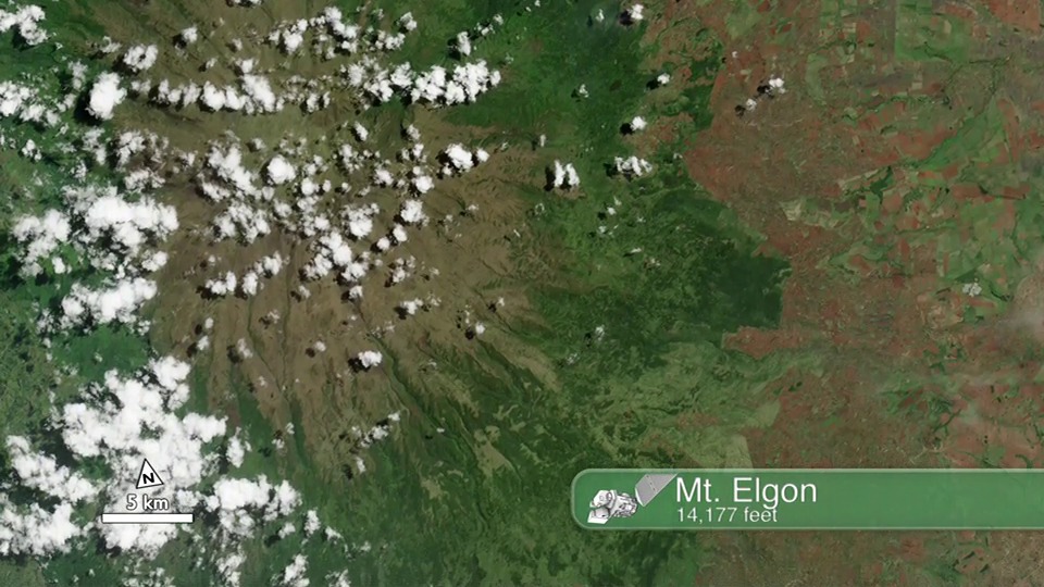
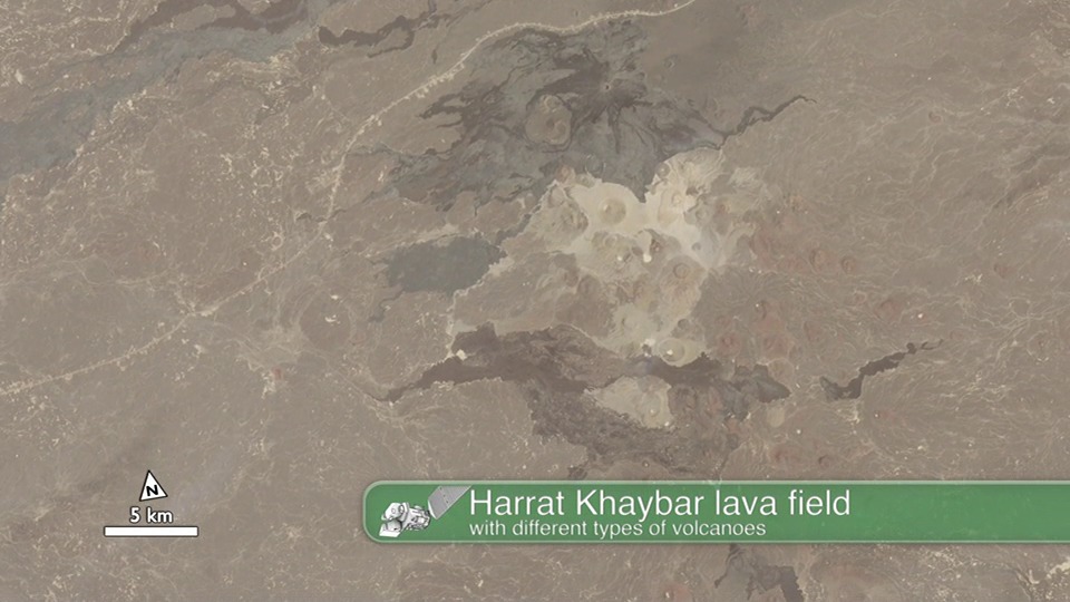
We pan down the long swath of data from Landsat 8, starting in northern Russia, passing over the Caucasus Mountains, the Republic of Georgia, Armenia, Turkey (passing Lake Van), Iraq, and Saudi Arabia (the cities of Medina and Jeddah), crossing the Red Sea into Eritrea, Ethiopia, the Kenya-Uganda border and catching the eastern edge of Lake Victoria, Tanzania, Zimbabwe, a little bit of Mozambique, and ending in northern South Africa.
Related

For More Information
Credits
Jesse Allen (Sigma Space Corporation): Lead Animator
Robert Simmon (Sigma Space Corporation): Animator
Alex Kekesi (Global Science and Technology, Inc.): Animator
Matthew R. Radcliff (USRA): Video Editor
Matthew R. Radcliff (USRA): Producer
James R. Irons (NASA/GSFC): Scientist
Holli Riebeek (Sigma Space Corporation): Writer
Mike Carlowicz (Sigma Space Corporation): Writer
Please give credit for this item to:
NASA's Goddard Space Flight Center and NASA's Earth Observatory
NASA's Goddard Space Flight Center and NASA's Earth Observatory
Short URL to share this page:
https://svs.gsfc.nasa.gov/11249
Mission:
Landsat
This item is part of these series:
Narrated Movies
Landsat
Goddard TV Tape:
G2013-049 -- LDCM Long Swath
Keywords:
SVS >> HDTV
SVS >> Landsat
SVS >> Land use
DLESE >> Physical geography
GCMD >> Earth Science >> Land Surface >> Land Use/Land Cover
SVS >> Hyperwall
NASA Science >> Earth
SVS >> Presentation
GCMD keywords can be found on the Internet with the following citation: Olsen, L.M., G. Major, K. Shein, J. Scialdone, S. Ritz, T. Stevens, M. Morahan, A. Aleman, R. Vogel, S. Leicester, H. Weir, M. Meaux, S. Grebas, C.Solomon, M. Holland, T. Northcutt, R. A. Restrepo, R. Bilodeau, 2013. NASA/Global Change Master Directory (GCMD) Earth Science Keywords. Version 8.0.0.0.0


