Earth
ID: 11151
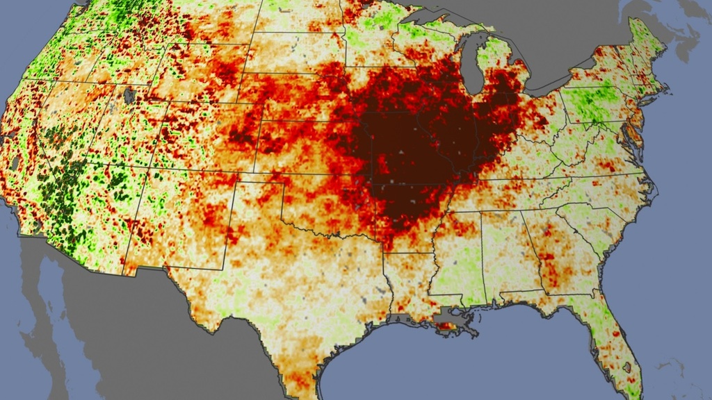
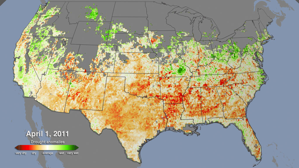
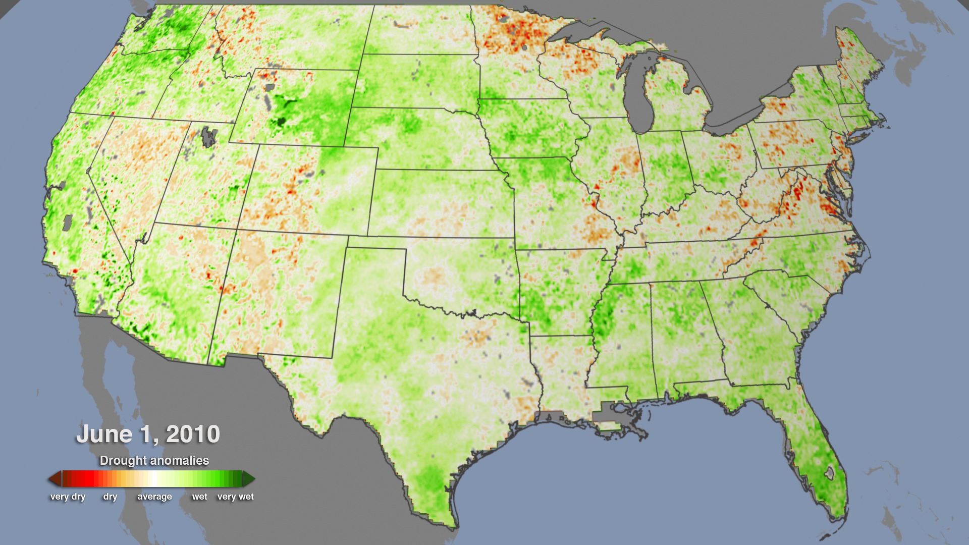
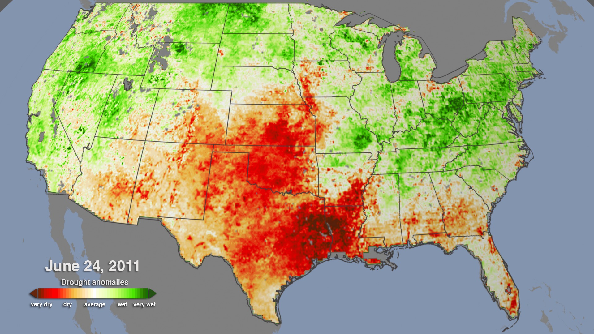
Rain let up and sweltering temperatures descended on the central U.S. in July 2012. On the ground, farmers saw crops wilt. From space, NASA and other satellites saw a pattern of drought spread across multiple states. When plants lack water, the stress ratchets up the temperature of their leaves. Likewise, when soil moisture is plentiful, plant leaves cool down. Instruments on satellites can detect this micro-scale biological response, giving scientists a new way of looking at drought on a large scale. In fact, the satellite instruments are capable of sensing imminent damage before plants themselves begin to wilt, potentially giving farmers an important warning weeks early. The visualization shows changing plant stress conditions across the U.S. from March 2010 to September 2012, including the impact of a 2012 summer heat wave that marked the most severe and extensive drought in the past 25 years.


Parched
Related Story

For More Information
Story Credits
Lead Visualizer/Animator:
Helen-Nicole Kostis (USRA)
Visualizers/Animators:
Horace Mitchell (NASA/GSFC)
Greg Shirah (NASA/GSFC)
Video Editor:
Michael Randazzo (Advocates in Manpower Management, Inc.)
Narrator:
Alison Schuyler Ogden (NASA/GSFC)
Producers:
Alison Schuyler Ogden (NASA/GSFC)
Matthew R. Radcliff (USRA)
Lead Scientists:
Martha C. Anderson (USDA-ARS-Hydrology and Remote Sensing Laboratory)
Wayne P. Dulaney (USDA-ARS-Hydrology and Remote Sensing Laboratory)
Chris Hain (NASA/MSFC)
Lead Writer:
Patrick Lynch (Wyle Information Systems)
Please give credit for this item to:
NASA's Goddard Space Flight Center
NASA's Goddard Space Flight Center
Short URL to share this page:
https://svs.gsfc.nasa.gov/11151
Keywords:
DLESE >> Narrated
SVS >> App
NASA Science >> Earth
https://svs.gsfc.nasa.gov/11151
Keywords:
DLESE >> Narrated
SVS >> App
NASA Science >> Earth


