Earth
ID: 11063
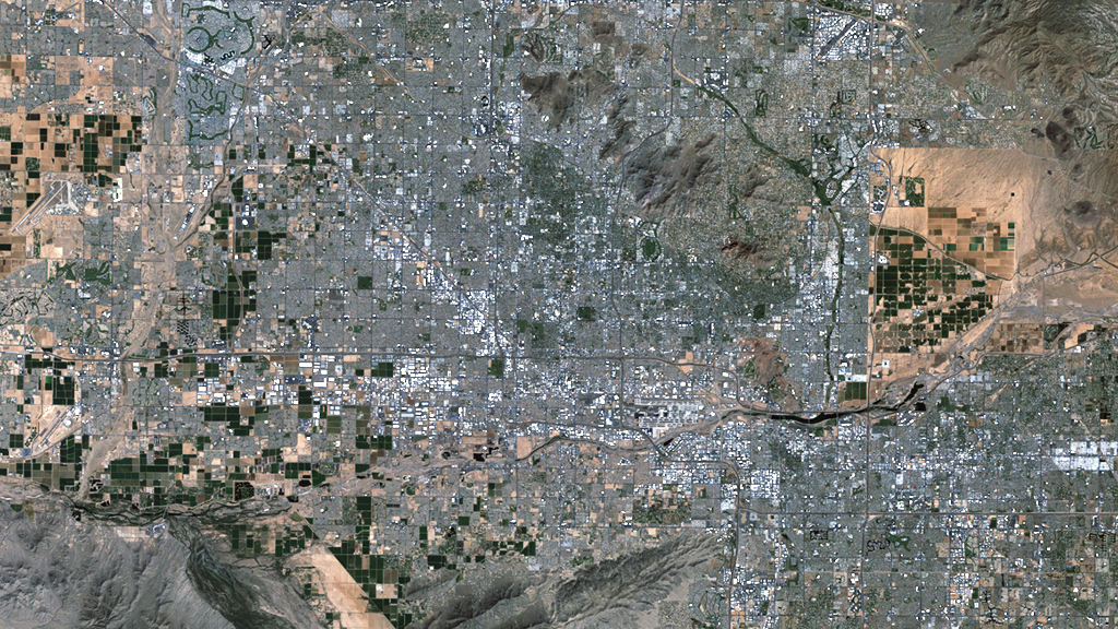
In the last forty years, Phoenix has grown to become one of the most populated places in the United States. The city and its surrounding area currently hold spots on the U.S. Census Bureau's top ten lists of cities and counties, ranking sixth and fourth, respectively. As Phoenix evolved from an agricultural to industrial economy, farmland was pushed to the outskirts in order to make way for suburban developments that stretched southeast and northwest of the city. Between 1974 and 2007, nearly 250,000 acres of agricultural fields were lost. During the same period a fourfold increase in residents brought the region's population to just below the 4 million mark. Witness the transformation of Phoenix in the time-lapse video of false color images captured by USGS-NASA Landsat satellites between 1972 and 2011.


Trading Spaces
Related Story

For More Information
Story Credits
Producer:
Matthew R. Radcliff (USRA)
Lead Scientist:
Roger Auch (USGS)
Lead Writer:
Ellen T. Gray (ADNET Systems, Inc.)
Matthew R. Radcliff (USRA)
Lead Scientist:
Roger Auch (USGS)
Lead Writer:
Ellen T. Gray (ADNET Systems, Inc.)
Please give credit for this item to:
NASA's Goddard Space Flight Center
Landsat is a joint program of NASA and USGS
NASA's Goddard Space Flight Center
Landsat is a joint program of NASA and USGS
Short URL to share this page:
https://svs.gsfc.nasa.gov/11063
Keywords:
SVS >> App
NASA Science >> Earth
https://svs.gsfc.nasa.gov/11063
Keywords:
SVS >> App
NASA Science >> Earth


