Earth
ID: 10982

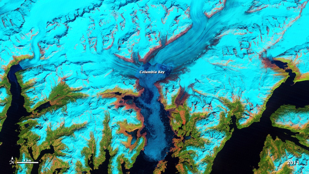
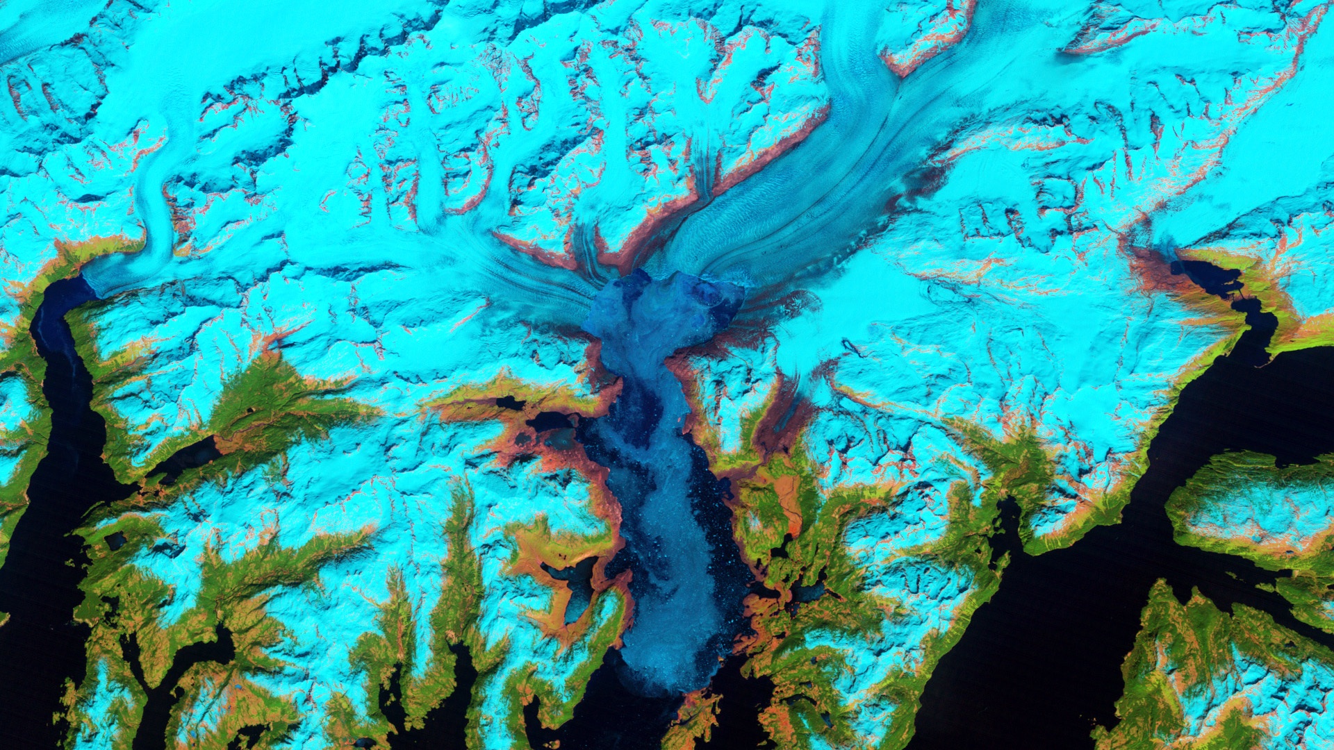
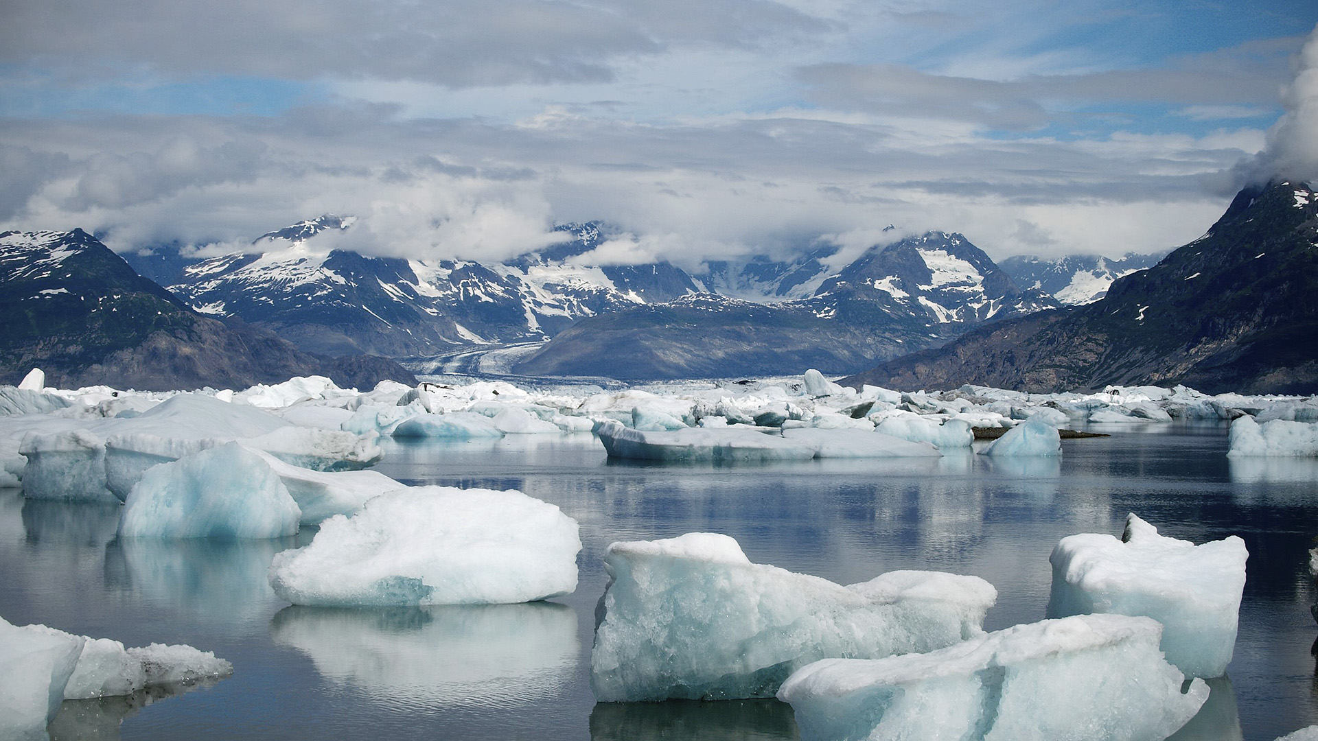
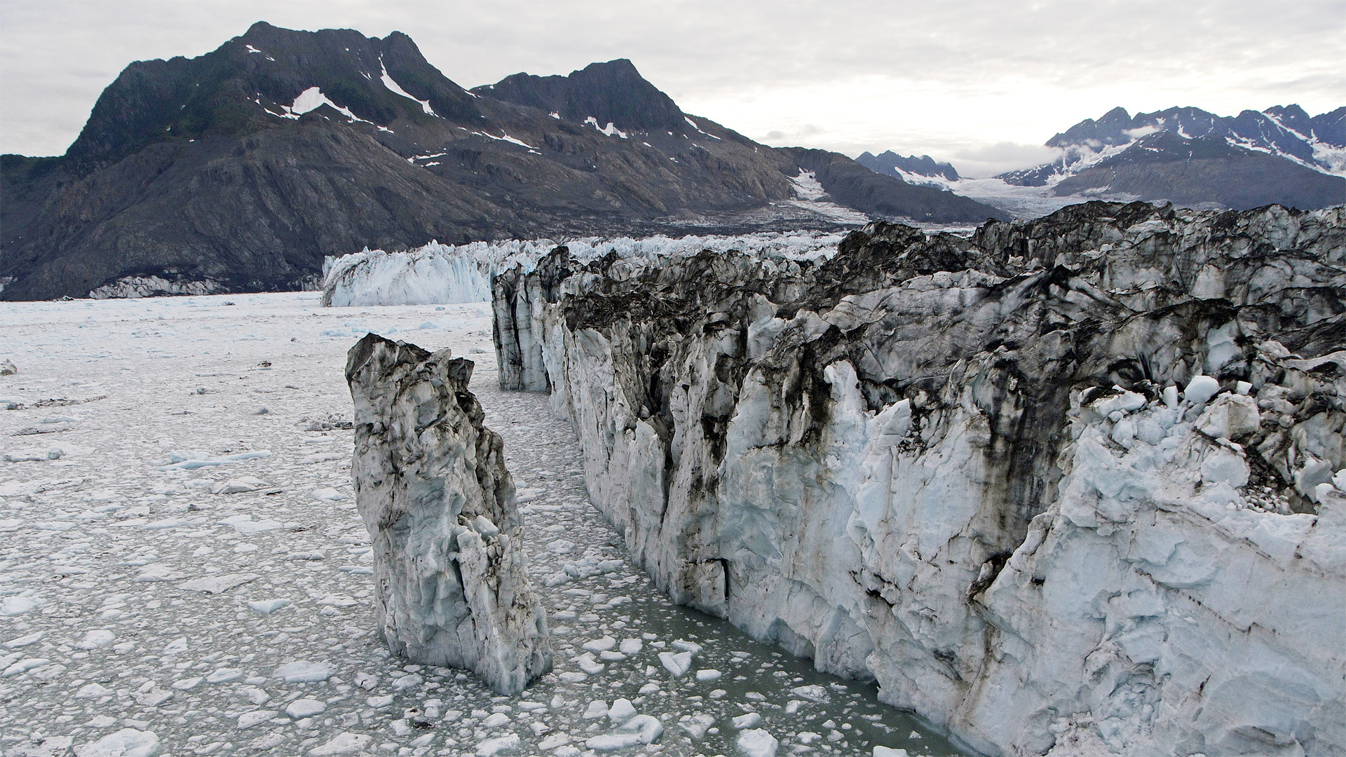
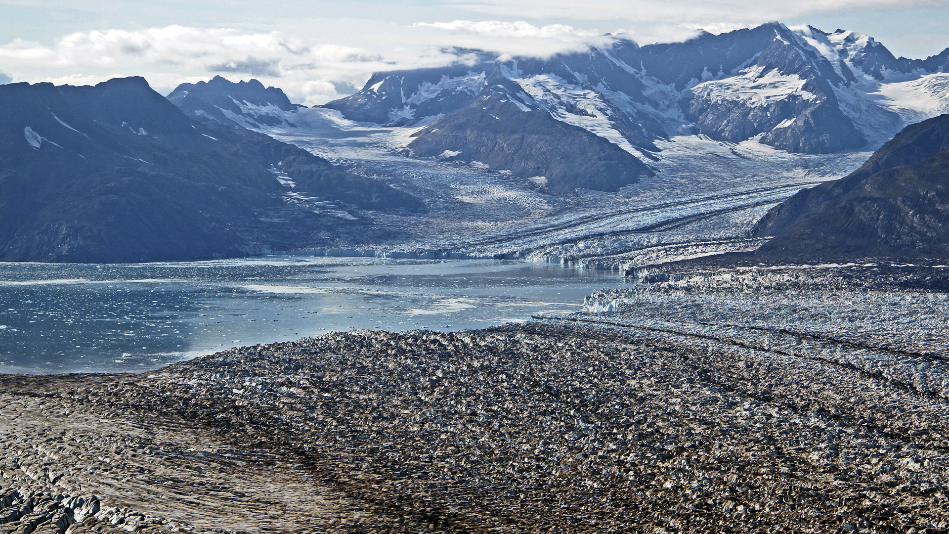
Columbia Glacier descends from an ice field 10,000 feet above sea level, through the flanks of Alaska's Chugach Mountains and into a narrow inlet. Since 1980, the glacier has lost about half of its thickness and volume, while the front where the glacier's ice meets open water—called the terminus—has retreated more than 12 miles. Climate change may have helped nudge the terminus off an underwater anchor of rock and debris that stabilized the ice for many years. Once it lost that footing, the lack of friction between ice and bedrock has driven a rapid loss of ice from the glacier to Columbia Bay. A time-lapse video of false-color images captured by USGS-NASA Landsat satellites shows how the glacier and the surrounding landscape changed between 1986 and 2011. Watch ice give way to ocean and bedrock become exposed as Columbia Glacier retreats.


Rapid Retreat
For More Information
Story Credits
Lead Visualizer/Animator:
Robert Simmon (Sigma Space Corporation)
Lead Writer:
Adam P. Voiland (Sigma Space Corporation)
Robert Simmon (Sigma Space Corporation)
Lead Writer:
Adam P. Voiland (Sigma Space Corporation)
Please give credit for this item to:
NASA Earth Observatory
Floating icebergs photo courtesy of Jon Von Atta, copyright 2008
Calving front photo courtesy of U.S. Army Engineer Research & Development Center
1969 aerial photo courtesy of National Snow and Ice Data Center
2004 aerial photo courtesy of National Snow and Ice Data Center/W.T. Pfeffer
2011 glacier terminus photo courtesy of USGS/Shad O'Neel
Short URL to share this page:
https://svs.gsfc.nasa.gov/10982
Keywords:
SVS >> App
NASA Science >> Earth
https://svs.gsfc.nasa.gov/10982
Keywords:
SVS >> App
NASA Science >> Earth


