Earth
ID: 10934
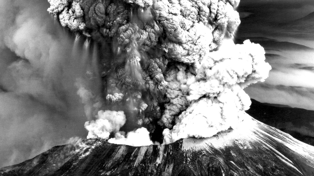
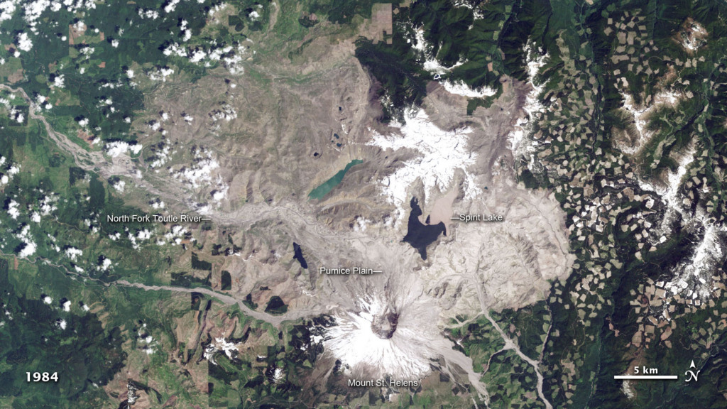
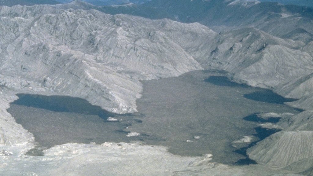
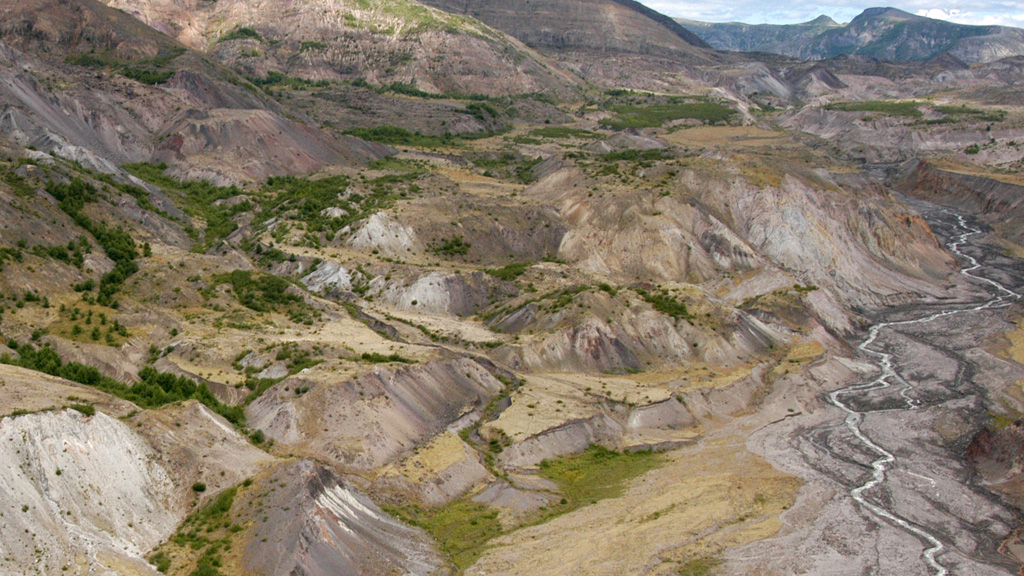
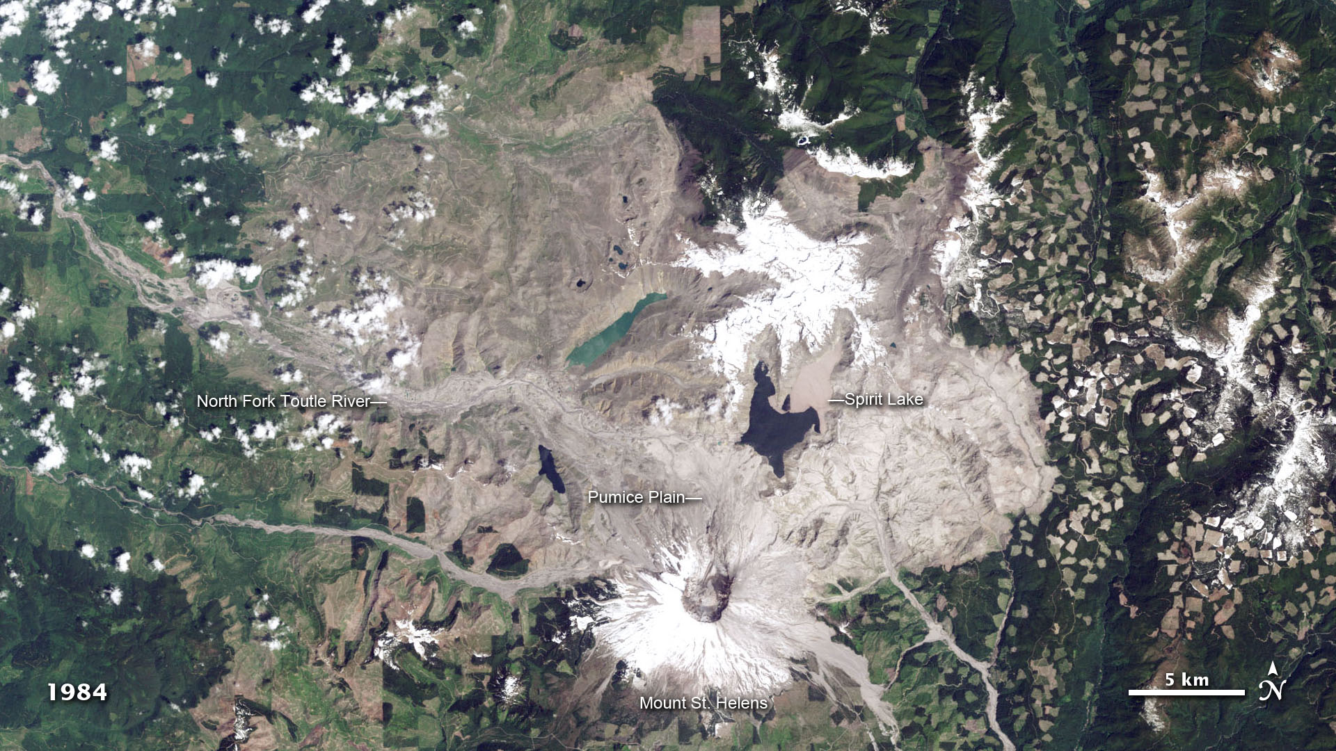
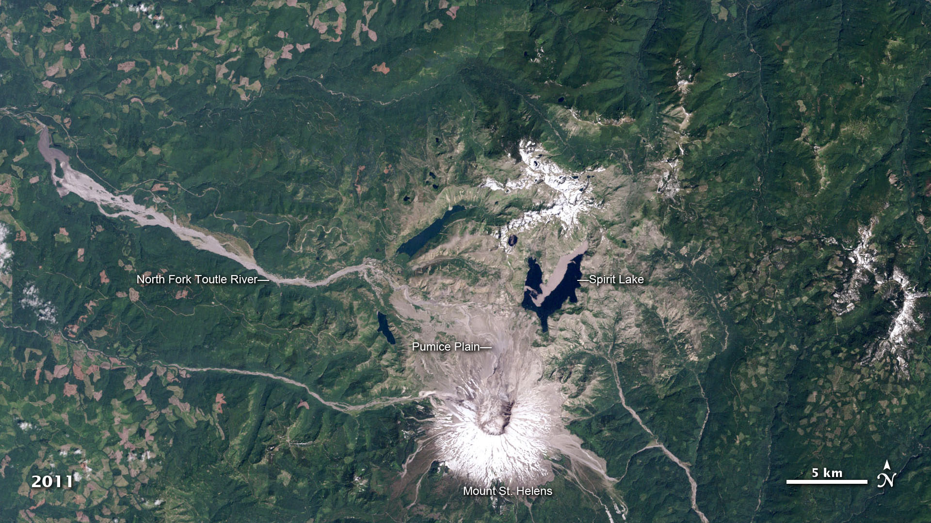
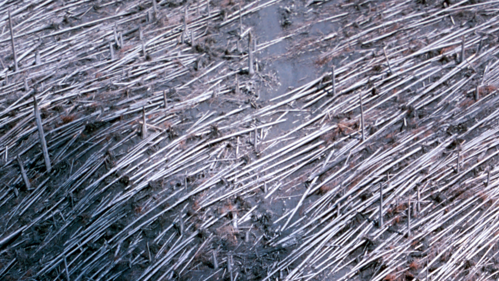
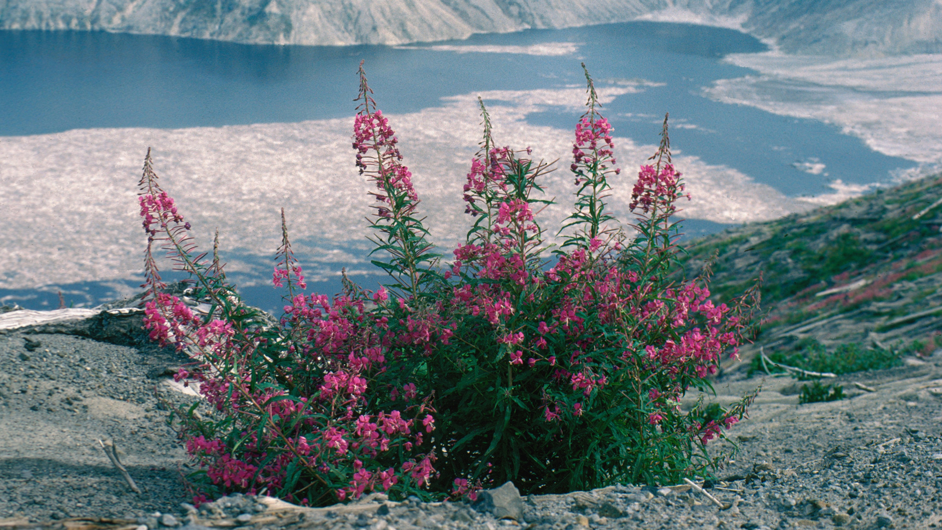
After two months of geologic volatility, an earthquake on May 18, 1980, triggered the northern flank of Mount St. Helens to collapse, sending an enormous avalanche of debris crashing toward the North Fork Toutle River in southwest Washington. Like a bottle of champagne shattering as it's uncorked, hot rocks, ash, gas and steam exploded from the volcano, obliterating the forested landscape to the north. The velocity of the blast exceeded speeds of 670 miles per hour, shearing trees at their trunks up to 19 miles away. The video below, based on images captured by USGS-NASA Landsat satellites between 1979 and 2011, documents the scale of the devastation and the surrounding vegetation's slow road to recovery. Some finer details aren't visible from space, so scientists have closely monitored the aftermath from the ground, as seen in photos taken from the USGS archive included in the media gallery.


Devastation And Recovery
For More Information
Story Credits
Lead Visualizer/Animator:
Robert Simmon (Sigma Space Corporation)
Lead Writer:
Adam P Voiland (Wyle Information Systems)
Robert Simmon (Sigma Space Corporation)
Lead Writer:
Adam P Voiland (Wyle Information Systems)
Please give credit for this item to:
NASA Earth Observatory
Photos courtesy of USGS: Mount St. Helens, Washington Regrowth and Recovery Images 1980-Current
NASA Earth Observatory
Photos courtesy of USGS: Mount St. Helens, Washington Regrowth and Recovery Images 1980-Current
Short URL to share this page:
https://svs.gsfc.nasa.gov/10934
Keywords:
SVS >> App
NASA Science >> Earth
https://svs.gsfc.nasa.gov/10934
Keywords:
SVS >> App
NASA Science >> Earth


