Earth
ID: 10820

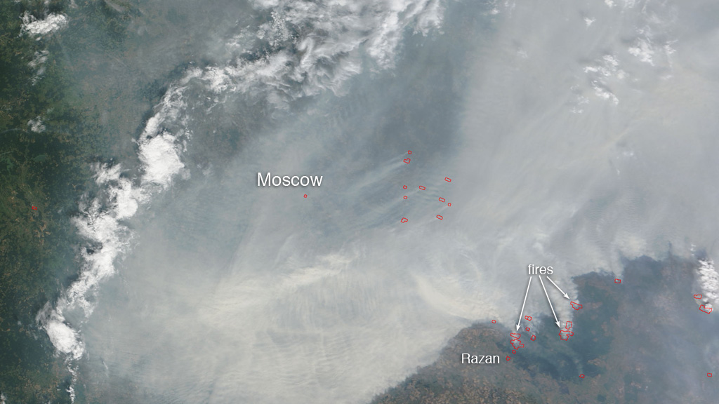
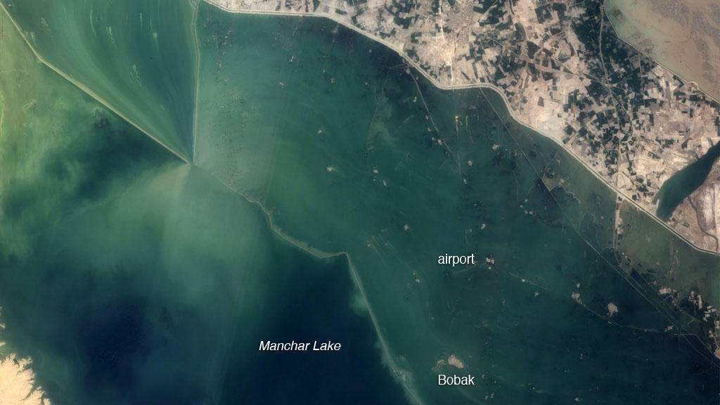
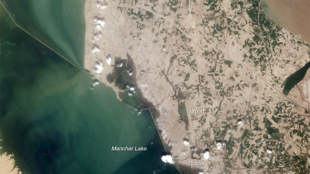
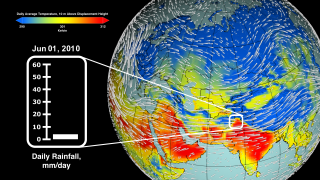
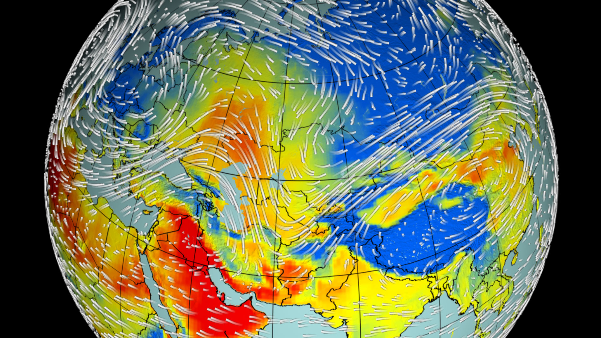
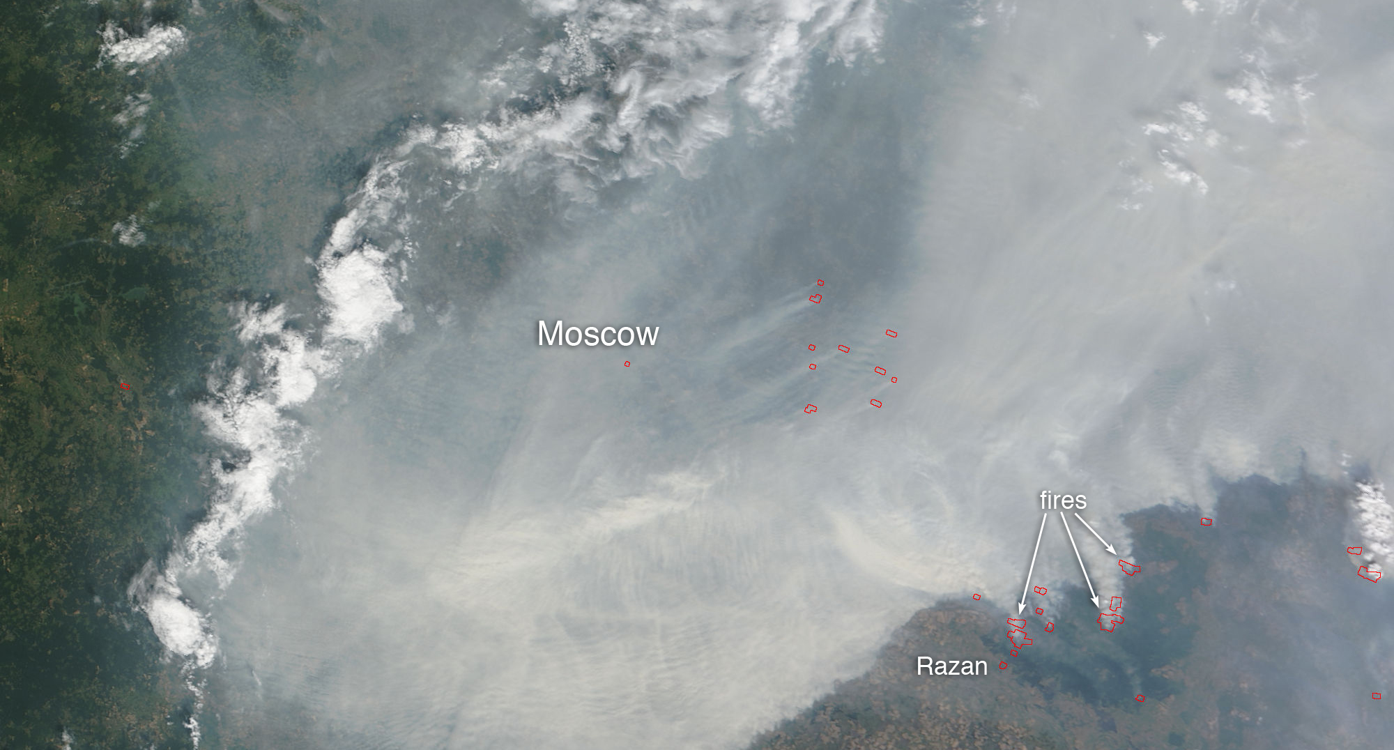
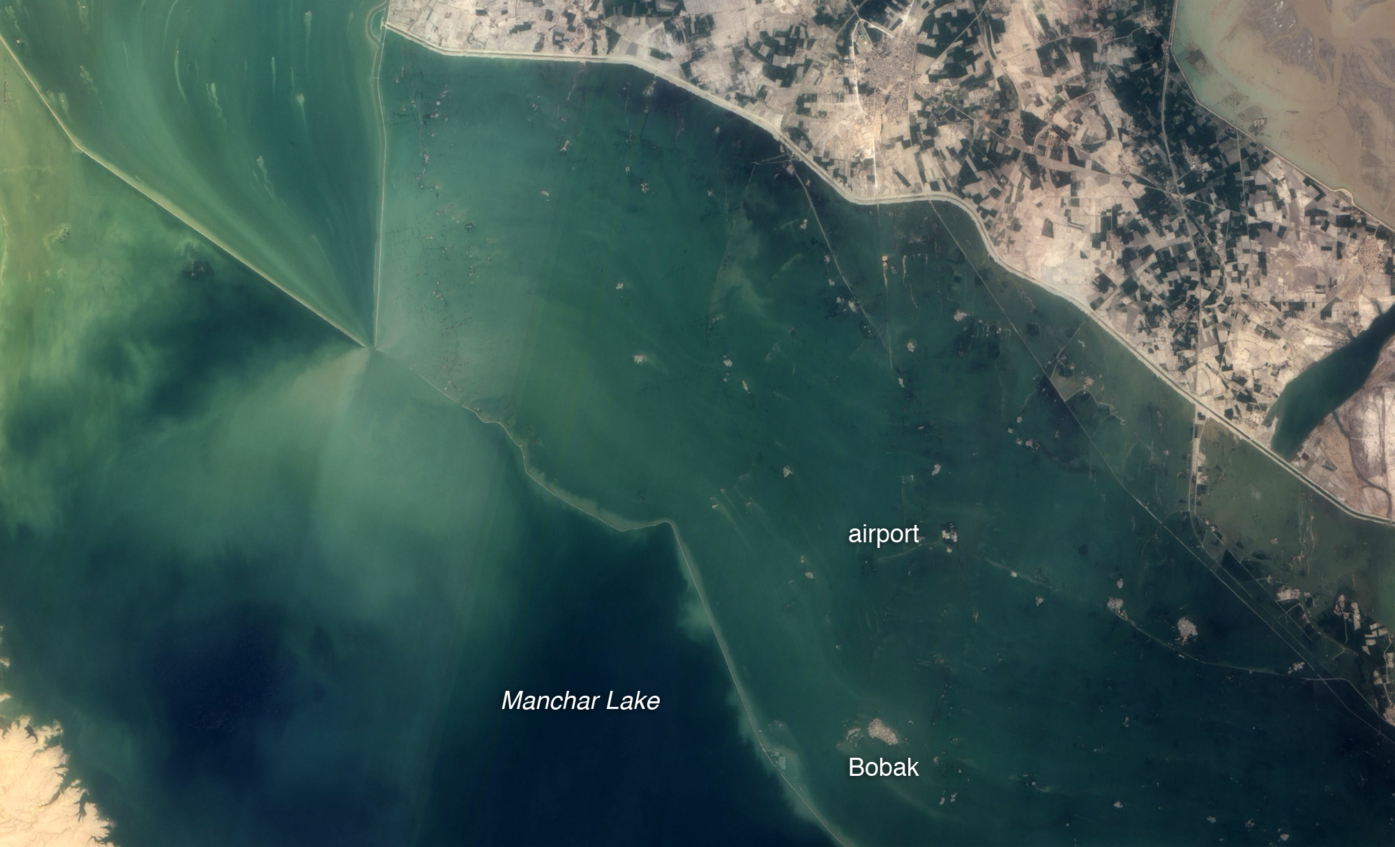
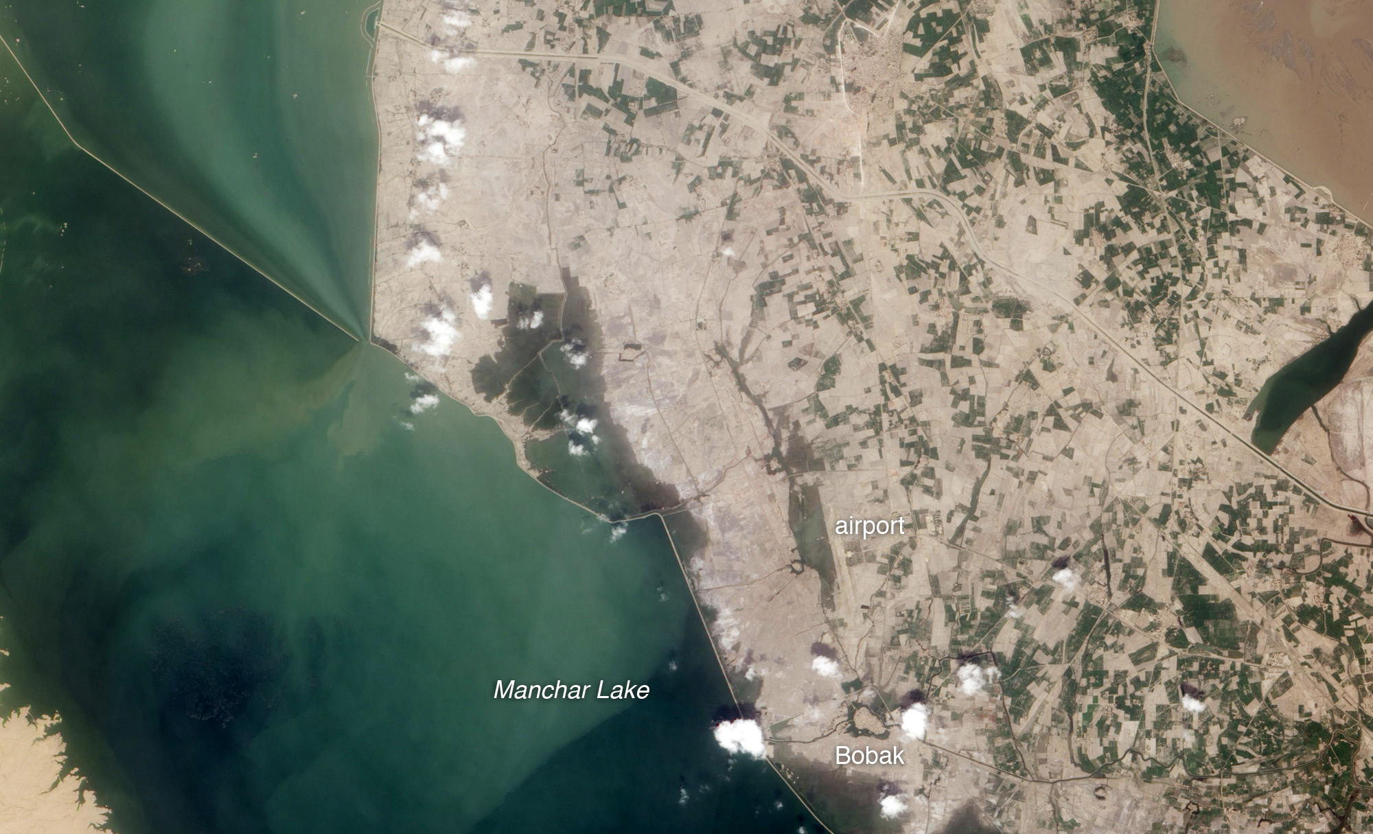
Normally the jet stream in the Northern Hemisphere carries weather fronts over Russia in four or five days. But late in the summer of 2010 conditions were anything but normal. A large-scale, stagnant region of high pressure developed and lingered over western Russia for about a month. The rare weather pattern—known to meteorologists as an Omega blocking high—split the jet stream in two, causing winds to flow around the high, an area of descending warm air, in a horseshoe-shaped pattern similar to that of the Greek letter Omega (Ω). The high blocked the normal progression of weather fronts and produced droughts and unusually warm temperatures that fueled a rash of fires near Moscow. As Russia burned, the same blocking pattern kept a low-pressure area over northern Pakistan. The cool, rising air of the low generated torrential rainfall and destructive flooding in northern Pakistan when it clashed with warmer air from the high. In the visualization below, look for the warm air from the persistent high-pressure zone over Russia (shown in yellow and red) and the cooler air from the low-pressure zone (shown in blue) just north of Pakistan.
Deconstructing Eurasia's Wild Weather
Related Story
Story Credits
Lead Visualizer/Animator:
Trent L. Schindler (USRA)
Producer:
Adam P Voiland (Wyle Information Systems)
Lead Scientists:
William K. Lau (NASA/GSFC)
Kyu-Myong Kim (Morgan State University)
Lead Writer:
Adam P Voiland (Wyle Information Systems)
Trent L. Schindler (USRA)
Producer:
Adam P Voiland (Wyle Information Systems)
Lead Scientists:
William K. Lau (NASA/GSFC)
Kyu-Myong Kim (Morgan State University)
Lead Writer:
Adam P Voiland (Wyle Information Systems)
Please give credit for this item to:
NASA's Goddard Space Flight Center
Images of Smoldering Fires in the Vicinity of Moscow and of Manchar Lake courtesy of Earth Observatory, NASA/GSFC
NASA's Goddard Space Flight Center
Images of Smoldering Fires in the Vicinity of Moscow and of Manchar Lake courtesy of Earth Observatory, NASA/GSFC
Science Paper:
http://journals.ametsoc.org/doi/abs/10.1175/JHM-D-11-016.1
Short URL to share this page:
https://svs.gsfc.nasa.gov/10820
Keywords:
NASA Science >> Earth
SVS >> App
http://journals.ametsoc.org/doi/abs/10.1175/JHM-D-11-016.1
Short URL to share this page:
https://svs.gsfc.nasa.gov/10820
Keywords:
NASA Science >> Earth
SVS >> App


