Earth
ID: 10752
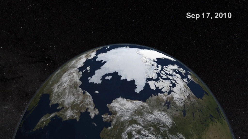
Ice near the poles is changing. In spring 2011, the annual maximum extent of Arctic sea ice was among the lowest in the satellite record. Using satellites to track Arctic ice and comparing it with previous years is one way that scientists gauge the Arctic's health and the impacts of climate change. Now, NASA scientists are in the field for the most recent leg of Operation IceBridge, a six year mission to study the Earth's polar regions, not from satellites, but from onboard aircraft. Over the next eight weeks, researchers will fly over the Arctic aboard airborne science laboratories, tracking changes to ice cover and glaciers, and even performing some measurements not possible from space.
OIB Arctic 2011 45-second Package
For more information, go to www.nasa.gov/icebridge
Credits
Please give credit for this item to:
NASA/Goddard Space Flight Center
NASA/Goddard Space Flight Center
Short URL to share this page:
https://svs.gsfc.nasa.gov/10752
Data Used:
Note: While we identify the data sets used in these visualizations, we do not store any further details nor the data sets themselves on our site.
This item is part of this series:
Narrated Movies
Keywords:
SVS >> Climate
DLESE >> Cryology
SVS >> HDTV
GCMD >> Earth Science >> Cryosphere
GCMD >> Location >> Greenland
GCMD >> Location >> Arctic
DLESE >> Narrated
SVS >> IceBridge
NASA Science >> Earth
GCMD keywords can be found on the Internet with the following citation: Olsen, L.M., G. Major, K. Shein, J. Scialdone, S. Ritz, T. Stevens, M. Morahan, A. Aleman, R. Vogel, S. Leicester, H. Weir, M. Meaux, S. Grebas, C.Solomon, M. Holland, T. Northcutt, R. A. Restrepo, R. Bilodeau, 2013. NASA/Global Change Master Directory (GCMD) Earth Science Keywords. Version 8.0.0.0.0
https://svs.gsfc.nasa.gov/10752
Data Used:
Aqua/AMSR-E
For more information, please click http://wwwghcc.msfc.nasa.gov/AMSR/
This item is part of this series:
Narrated Movies
Keywords:
SVS >> Climate
DLESE >> Cryology
SVS >> HDTV
GCMD >> Earth Science >> Cryosphere
GCMD >> Location >> Greenland
GCMD >> Location >> Arctic
DLESE >> Narrated
SVS >> IceBridge
NASA Science >> Earth
GCMD keywords can be found on the Internet with the following citation: Olsen, L.M., G. Major, K. Shein, J. Scialdone, S. Ritz, T. Stevens, M. Morahan, A. Aleman, R. Vogel, S. Leicester, H. Weir, M. Meaux, S. Grebas, C.Solomon, M. Holland, T. Northcutt, R. A. Restrepo, R. Bilodeau, 2013. NASA/Global Change Master Directory (GCMD) Earth Science Keywords. Version 8.0.0.0.0


