Earth
ID: 10732
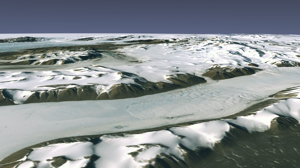
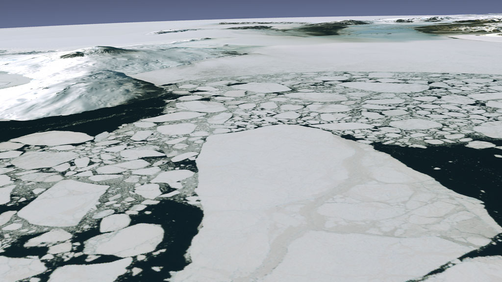
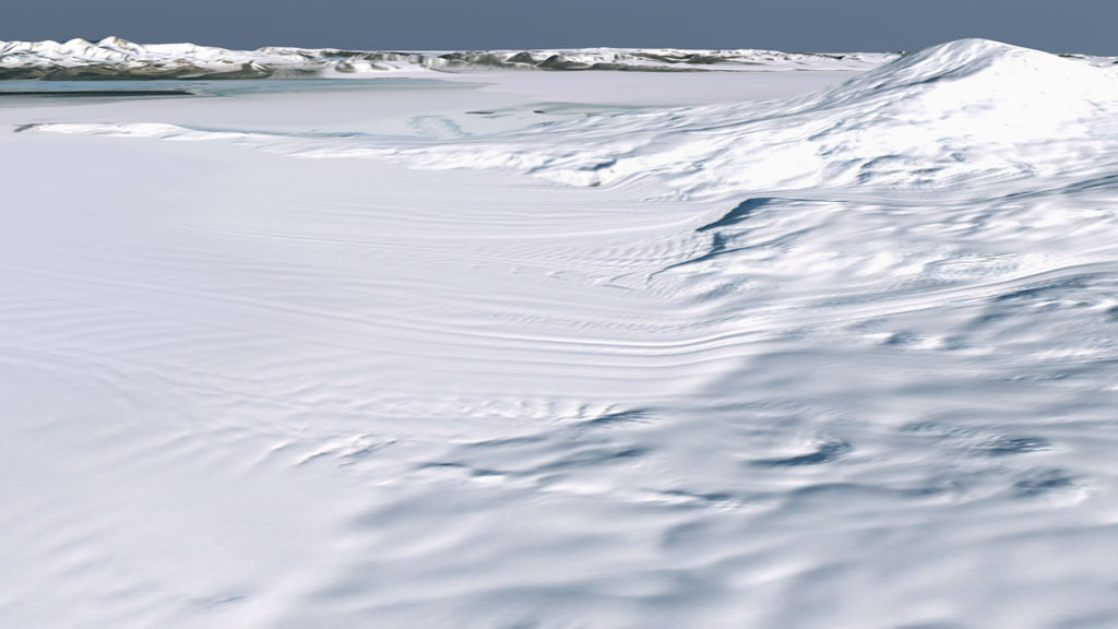
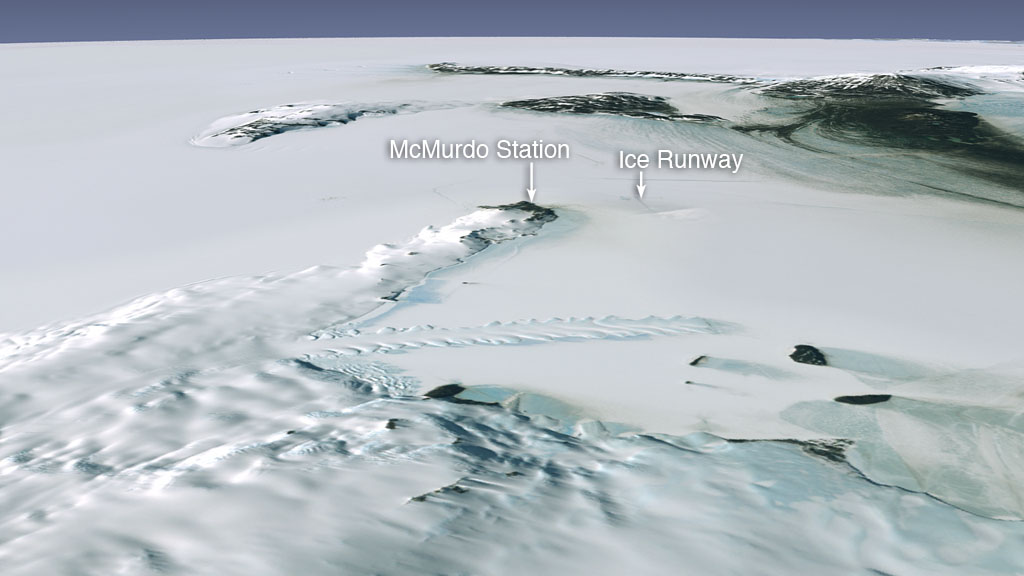
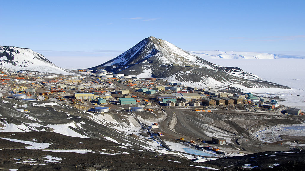
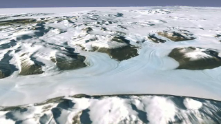
We've grown used to seeing landscapes from above. The terrain that early explorers once took years to cross we now conquer during a routine business flight on a weekday morning. Yet there remain places too remote and too rugged for most to reach. This is Antarctica, where ice sheets stretch across the eastern part of the continent like a frozen Great Plains, and mountains that would be at home in the Rockies crop up in nearly snow-free, dry regions. Otherwise experienced by only a small group of scientists and polar travelers, NASA, in partnership with the National Science Foundation, the U.S. Geological Survey, and the British Antarctic Survey, has made Antarctica accessible to all by piecing together Landsat 7 satellite images to create a mosaic that represents the first true-color, high-resolution map of the continent. Even without crampons and an ice ax, you can now explore one of the world's most brutal environments in this flyover view of Antarctica.
Coldest Map In The World
Related Story
Story Credits
Visualizer/Animator:
Lori Perkins (NASA/GSFC)
Video Editor:
Michelle Williams (UMBC)
Narrator:
Laura Motel (UMBC)
Producers:
Michelle Williams (UMBC)
Andrew Freeberg (NASA/GSFC)
Ryan Fitzgibbons (USRA)
Jefferson Beck (USRA)
Lead Scientist:
Bob Bindschadler (NASA/GSFC)
Lead Writer:
Patrick Lynch (Wyle Information Systems)
Please give credit for this item to:
NASA's Goddard Space Flight Center
The Landsat Program is a series of Earth-observing satellite missions jointly managed by NASA and the U.S. Geological Survey
NASA's Goddard Space Flight Center
The Landsat Program is a series of Earth-observing satellite missions jointly managed by NASA and the U.S. Geological Survey
Short URL to share this page:
https://svs.gsfc.nasa.gov/10732
This item is part of this series:
Landsat Image Mosaic of Antarctica
Keywords:
DLESE >> Narrated
SVS >> App
NASA Science >> Earth
https://svs.gsfc.nasa.gov/10732
This item is part of this series:
Landsat Image Mosaic of Antarctica
Keywords:
DLESE >> Narrated
SVS >> App
NASA Science >> Earth


