Earth
ID: 10723
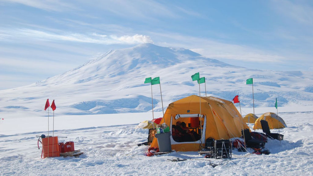
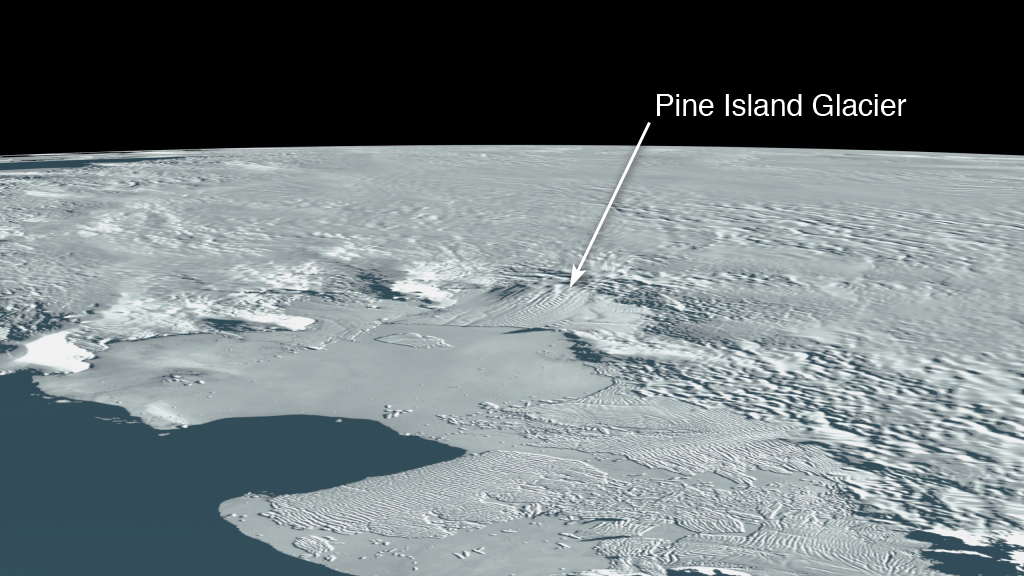
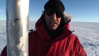
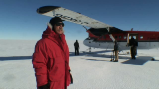
Stretching off the edge of the continent, 1,400 miles west of Antarctica's McMurdo Station, is Pine Island Glacier (PIG)—a massive river of ice 190 miles wide and 30 miles long that satellite measurements reveal is rapidly shrinking in size. Much of the glacier rests on a bed below sea level and global sea levels could increase by three feet or more if the glacier melted completely. The rate of ice loss on the glacier has increased rapidly in recent years, and scientists believe shifting warm water rising from the adjacent deep ocean and circulating in the surrounding Amundsen Sea are rapidly melting the underside of the glacier's floating edge—the ice shelf. To be certain requires measurements taken beneath this floating ice. That's where NASA polar scientist Robert Bindschadler comes in. In 2008, Bindschadler led an expedition to the remote ice shelf by plane, but the dangers of landing on the crevassed surface prevented his team from collecting data. This fall Bindschadler will return via helicopter. The plan on arrival: drill 1,640 feet below the surface and deploy a specially designed instrument that will start continuous measurements of the shifting ocean waters beneath the glacier.
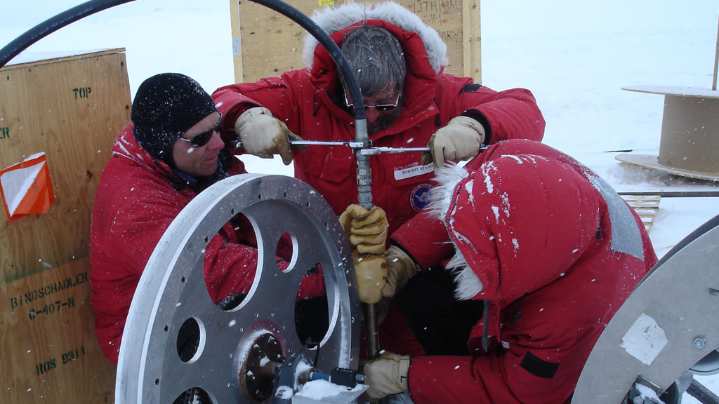
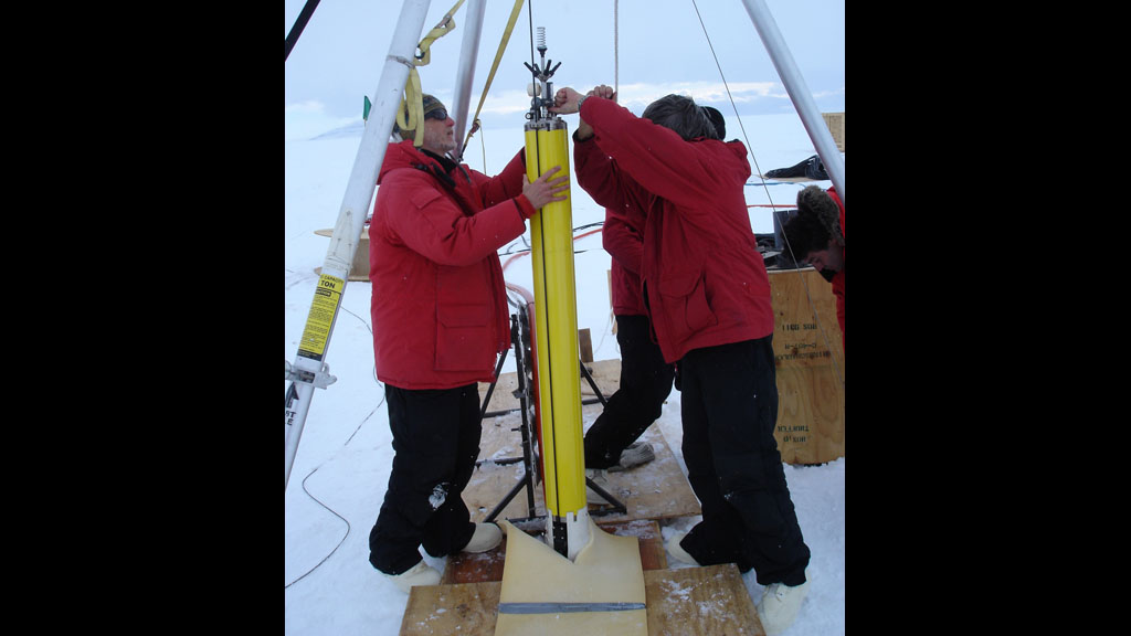
Base Camp: West Antarctica
Related Stories

Story Credits
Lead Visualizer/Animator:
Lori Perkins (NASA/GSFC)
Visualizers/Animators:
Chris Meaney (HTSI)
Susan Twardy (HTSI)
Video Editors:
Victoria Weeks (HTSI)
Jefferson Beck (UMBC)
Interviewee:
Bob Bindschadler (NASA/GSFC)
Producers:
Victoria Weeks (HTSI)
Jefferson Beck (UMBC)
Lead Scientist:
Bob Bindschadler (NASA/GSFC)
Lead Writers:
Adam P Voiland (Wyle Information Systems)
Patrick Lynch (Wyle Information Systems)
Kathryn Hansen (Wyle Information Systems)
Kayvon Sharghi (USRA)
Please give credit for this item to:
NASA's Goddard Space Flight Center
NASA's Goddard Space Flight Center
Short URL to share this page:
https://svs.gsfc.nasa.gov/10723
Keywords:
SVS >> App
NASA Science >> Earth
https://svs.gsfc.nasa.gov/10723
Keywords:
SVS >> App
NASA Science >> Earth


