Earth
ID: 10715

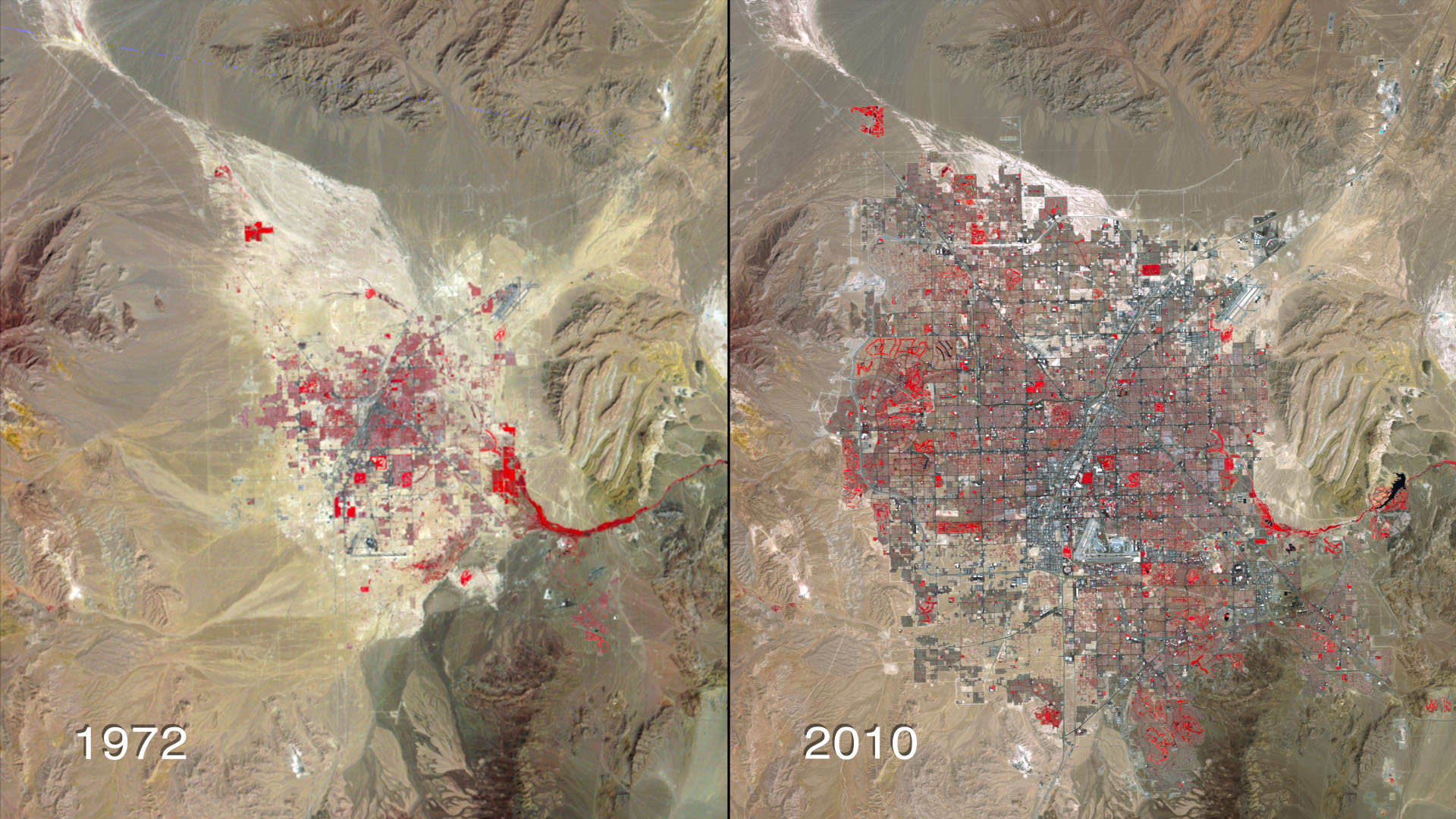
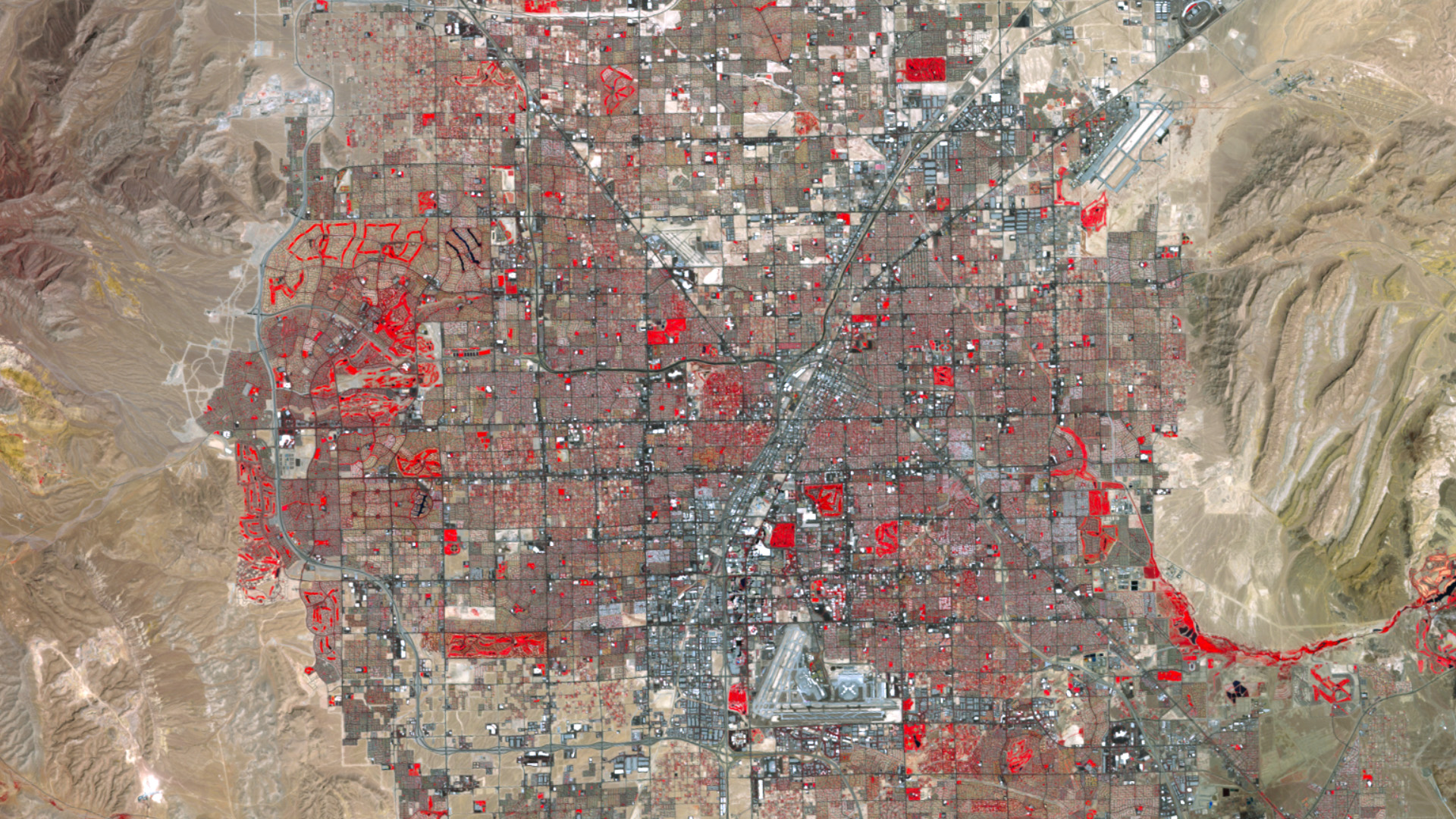
The constant influx of residents to Las Vegas since the 1970s has made it one of the fastest-growing metropolitan areas in the world. Currently more than 2 million people live in the 600-square-mile desert region, centered around the world-famous Las Vegas Strip and its luxury resorts and casinos. No doubt, the steady commercial and residential development over the last 40 years has been a boon to the valley's economy, but dense urbanization has exacted a high price on its most vital natural resource: water. Abundant parks, golf courses and manicured landscapes in Las Vegas' arid climate require more water to maintain than they naturally receive. This has placed an unsustainable demand on the region's primary water supply—Lake Mead—where water levels have fallen in the past decade due to persistent drought experienced across the Southwest. Scientists predict drought frequency and intensity for the region will only increase as global temperatures rise. In the collection of false-color, time-lapse images below captured by USGS-NASA Landsat satellites, witness Las Vegas' explosive growth from 1972 to 2010.


Tapped Dry In Vegas
Related Story

For More Information
Story Credits
Visualizer/Animator:
Marit Jentoft-Nilsen (RSIS)
Video Editor:
Matthew R. Radcliff (USRA)
Producer:
Matthew R. Radcliff (USRA)
Lead Scientist:
James R. Irons (NASA/GSFC)
Lead Writer:
Kayvon Sharghi (USRA)
Marit Jentoft-Nilsen (RSIS)
Video Editor:
Matthew R. Radcliff (USRA)
Producer:
Matthew R. Radcliff (USRA)
Lead Scientist:
James R. Irons (NASA/GSFC)
Lead Writer:
Kayvon Sharghi (USRA)
Please give credit for this item to:
NASA's Goddard Space Flight Center
Landsat images obtained from USGS Earth Explorer
Night photograph of Las Vegas obtained from The Gateway to Astronaut Photography of Earth, Image Science and Analysis Laboratory, NASA-Johnson Space Center
The Landsat Program is a series of Earth-observing satellite missions jointly managed by NASA and the U.S. Geological Survey.
Short URL to share this page:
https://svs.gsfc.nasa.gov/10715
Keywords:
SVS >> HDTV
SVS >> Hyperwall
SVS >> App
NASA Science >> Earth
https://svs.gsfc.nasa.gov/10715
Keywords:
SVS >> HDTV
SVS >> Hyperwall
SVS >> App
NASA Science >> Earth


