Earth
ID: 10588
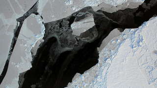
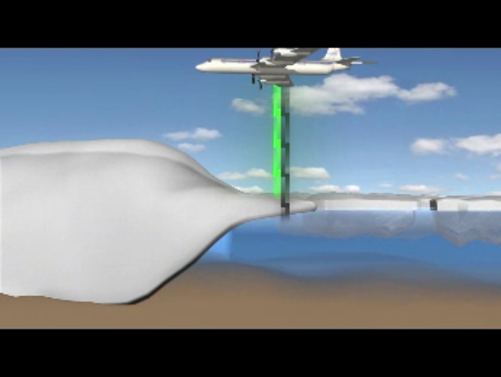
Laser and radar instruments aboard NASA aircraft provide measurements of the snow and ice surface and down to the bedrock under the ice. Lasers, with a shorter wavelength, measure the surface elevation of the snow or ice to within a fraction of an inch. Radar instruments utilize a longer wavelength and can penetrate the ice to "see" below the surface, providing a profile of ice characteristics and also the shape of the bedrock. This information is critical for understanding how and why the world's biggest ice masses are changing.
Laser Radar Animation
Related
Credits
Megan Willy (IRC/UMBC): Lead Animator
Michelle Williams (UMBC): Producer
Lora Koenig (NASA/GSFC): Scientist
Thorsten Markus (NASA/GSFC): Scientist
Michelle Williams (UMBC): Producer
Lora Koenig (NASA/GSFC): Scientist
Thorsten Markus (NASA/GSFC): Scientist
Please give credit for this item to:
NASA/Goddard Space Flight Center
NASA/Goddard Space Flight Center
Short URL to share this page:
https://svs.gsfc.nasa.gov/10588
Goddard TV Tape:
G2010-017 -- Operation Ice Bridge (Greenland, Spring 2010) Video File 1
Keywords:
SVS >> HDTV
NASA Science >> Earth
https://svs.gsfc.nasa.gov/10588
Goddard TV Tape:
G2010-017 -- Operation Ice Bridge (Greenland, Spring 2010) Video File 1
Keywords:
SVS >> HDTV
NASA Science >> Earth


