Earth
Planets and Moons
ID: 10517
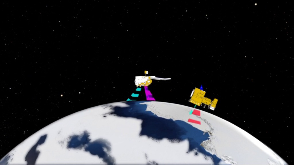
Satellite remote sensing is a tool for gathering information, usually about what is at the surface of Earth or planets and their moons, but also about the atmosphere. Remote sensing data are commonly combined with other kinds of data (typically, from field or "on-the-spot" studies [commonly called ground truth]) to act together as a system (for example, Geographic Information Systems, or GIS.
Remote Sensing Conceptual Animation
Related

Credits
Megan Willy (IRC/UMBC): Animator
Ivy Flores (IRC/UMBC): Animator
Michelle Williams (UMBC): Producer
Jennifer A. Shoemaker (UMBC): Producer
Jefferson Beck (UMBC): Producer
Ivy Flores (IRC/UMBC): Animator
Michelle Williams (UMBC): Producer
Jennifer A. Shoemaker (UMBC): Producer
Jefferson Beck (UMBC): Producer
Please give credit for this item to:
NASA/Goddard Space Flight Center
NASA/Goddard Space Flight Center
Short URL to share this page:
https://svs.gsfc.nasa.gov/10517
This item is part of this series:
Agriculture Animations - Global Agricultural Monitoring
Keywords:
SVS >> HDTV
SVS >> Remote Sensing
SVS >> Satellite
NASA Science >> Earth
NASA Science >> Planets and Moons
https://svs.gsfc.nasa.gov/10517
This item is part of this series:
Agriculture Animations - Global Agricultural Monitoring
Keywords:
SVS >> HDTV
SVS >> Remote Sensing
SVS >> Satellite
NASA Science >> Earth
NASA Science >> Planets and Moons


