Five-Year Average Global Temperature Anomalies from 1880 to 2010
Groups of scientists from several major institutions - NASA's Goddard Institute for Space Studies (GISS), NOAA's National Climatic Data Center (NCDC), the Japanese Meteorological Agency and the Met Office Hadley Centre in the United Kingdom - tally data collected by temperature monitoring stations spread around the world and make an announcement about whether the previous year was a comparatively warm or cool year. This analysis concerns only temperature anomalies, not absolute temperature. Temperature anomalies are computed relative to the base period 1951-1980. The reason to work with anomalies, rather than absolute temperature is that absolute temperature varies markedly in short distances, while monthly or annual temperature anomalies are representative of a much larger region. Indeed, we have shown (Hansen and Lebedeff, 1987) that temperature anomalies are strongly correlated out to distances of the order of 1000 km. For more information about this dataset, see http://data.giss.nasa.gov/gistemp
NASA's announcement this year - that 2010 ties 2005 as the warmest year in the 131-year instrumental record - made headlines. But, how much does the ranking of a single year matter?
Not all that much, emphasizes James Hansen, the director of NASA's Goddard Institute for Space Studies (GISS) in New York City. In the GISS analysis, for example, 2010 differed from 2005 by less than 0.01°C (0.018°F), a difference so small that the temperatures of these two years are indistinguishable, given the uncertainty of the calculation.
Meanwhile, the third warmest year - 2009 - is so close to 1998, 2002, 2003, 2006, and 2007, with the maximum difference between the years being a mere 0.03°C, that all six years are virtually tied.
Even for a near record-breaking year like 2010 the broader context is more important than a single year. "Certainly, it is interesting that 2010 was so warm despite the presence of a La Niña and a remarkably inactive sun, two factors that have a cooling influence on the planet, but far more important than any particular year's ranking are the decadal trends," Hansen said.
This color-coded map displays a progression of changing global surface temperatures anomalies from 1880 through 2010. The final frame represents global temperature anomalies averaged from 2006 to 2010.
This visualization shows the same data as above with the corresponding date overlay applied.
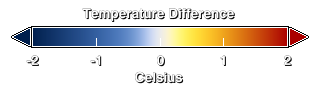
Temperature difference colorbar.
This frame set and this movie of the five-year global temperature anomalies from 1880 through 2010 are made to be displayed on the Science On a Sphere display.

Global Temperature Anomalies averaged from 1880 to 1884.
Global Temperature Anomalies averaged from 1890 to 1894.
Global Temperature Anomalies averaged from 1900 to 1904.
Global Temperature Anomalies averaged from 1910 to 1914.
Global Temperature Anomalies averaged from 1920 to 1924.
Global Temperature Anomalies averaged from 1930 to 1934.
Global Temperature Anomalies averaged from 1940 to 1944.
Global Temperature Anomalies averaged from 1950 to 1954.
Global Temperature Anomalies averaged from 1960 to 1964.
Global Temperature Anomalies averaged from 1970 to 1974.
Global Temperature Anomalies averaged from 1980 to 1984.
Global Temperature Anomalies averaged from 1990 to 1994.
Global Temperature Anomalies averaged from 2000 to 2004.
Credits
Please give credit for this item to:
NASA/Goddard Space Flight Center Scientific Visualization Studio
Data provided by Robert B. Schmunk (NASA/GSFC GISS)
-
Animator
- Lori Perkins (NASA/GSFC)
-
Producer
- Brooke Harris (UMBC)
-
Scientists
- James Hansen (NASA/GSFC GISS)
- Reto A. Ruedy (SIGMA Space Partners, LLC.)
- Kwok-Wai Ken Lo (SIGMA Space Partners, LLC.)
- Makiko Sato (Columbia University, Center for Climate Systems Research)
- Robert B Schmunk (SIGMA Space Partners, LLC.)
-
Project support
- Robert B Schmunk (SIGMA Space Partners, LLC.)
-
Writer
- Adam P Voiland (Wyle Information Systems)
Release date
This page was originally published on Friday, January 14, 2011.
This page was last updated on Wednesday, May 3, 2023 at 1:53 PM EDT.
Series
This visualization can be found in the following series:Papers used in this visualization
*Hansen, J., R. Ruedy, Mki. Sato, and K. Lo, 2010: Global surface temperature change. Rev. Geophys., 48, RG4004, doi:10.1029/2010RG000345.
Model documentation, including the ModelE specification and results from three standard configurations, is given in the following journal article:
* Schmidt, G.A., R. Ruedy, J.E. Hansen, I. Aleinov, N. Bell, M. Bauer, S. Bauer, B. Cairns, V. Canuto, Y. Cheng, A. Del Genio, G. Faluvegi, A.D. Friend, T.M. Hall, Y. Hu, M. Kelley, N.Y. Kiang, D. Koch, A.A. Lacis, J. Lerner, K.K. Lo, R.L. Miller, L. Nazarenko, V. Oinas, Ja. Perlwitz, Ju. Perlwitz, D. Rind, A. Romanou, G.L. Russell, Mki. Sato, D.T. Shindell, P.H. Stone, S. Sun, N. Tausnev, D. Thresher, and M.-S. Yao 2006. Present day atmospheric simulations using GISS ModelE: Comparison to in-situ, satellite and reanalysis data. J. Climate 19, 153-192.
Datasets used in this visualization
-
GISTEMP [GISS Surface Temperature Analysis (GISTEMP)]
ID: 585The GISS Surface Temperature Analysis version 4 (GISTEMP v4) is an estimate of global surface temperature change. Graphs and tables are updated around the middle of every month using current data files from NOAA GHCN v4 (meteorological stations) and ERSST v5 (ocean areas), combined as described in our publications Hansen et al. (2010) and Lenssen et al. (2019).
Credit: Lenssen, N., G. Schmidt, J. Hansen, M. Menne, A. Persin, R. Ruedy, and D. Zyss, 2019: Improvements in the GISTEMP uncertainty model. J. Geophys. Res. Atmos., 124, no. 12, 6307-6326, doi:10.1029/2018JD029522.
This dataset can be found at: https://data.giss.nasa.gov/gistemp/
See all pages that use this dataset
Note: While we identify the data sets used in these visualizations, we do not store any further details, nor the data sets themselves on our site.