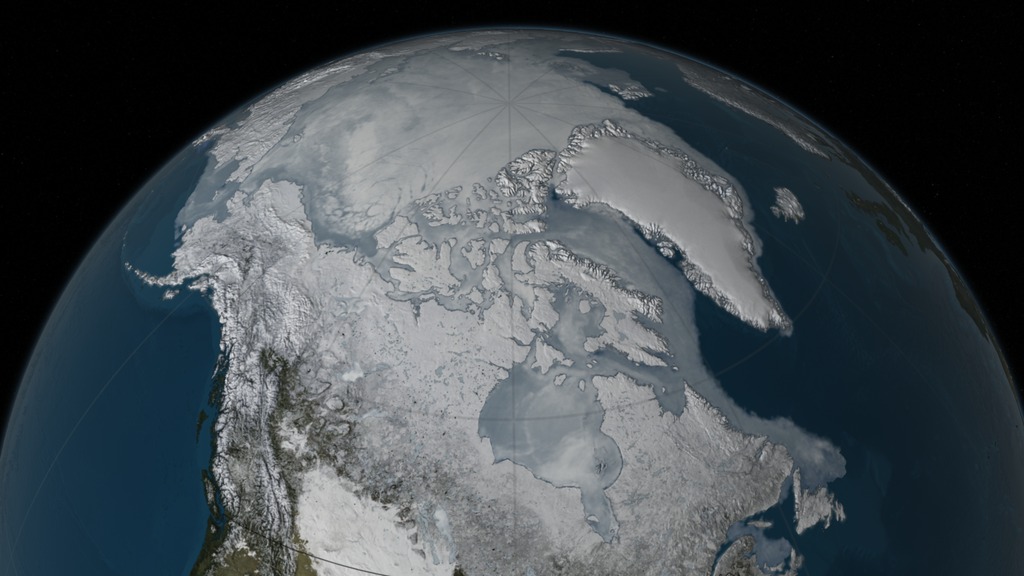
AMSR-E Arctic Sea Ice Yearly Maximum from 2003 through 2009
Sea ice is frozen seawater floating on the surface of the ocean, typically averaging a few meters in thickness. Some sea ice is semi-permanent, persisting from year to year, and some is seasonal, melting and refreezing from season to season. The sea ice cover reaches its maximum extent at the end of each winter, generally in February or March. This series of images of the yearly sea ice maximum extent depicts data from the AMSR-E instrument on the Aqua satellite. The false color in these images of sea ice is derived from the daily AMSR-E 6.25 km 89 GHz brightness temperature while the sea ice extent is derived from the daily AMSR-E 12.5 km sea ice concentration.

The 2009 maximum sea ice extent that occurred on February 28, 2009.
The 2008 maximum sea ice extent that occurred on March 9, 2008.
The 2007 maximum sea ice extent that occurred on March 11, 2007.
The 2006 maximum sea ice extent that occurred on March 10, 2006.
The 2005 maximum sea ice extent that occurred on March 7, 2005.
The 2004 maximum sea ice extent that occurred on February 27, 2004.
The 2003 maximum sea ice extent that occurred on March 20, 2003.
Credits
Please give credit for this item to:
NASA/Goddard Space Flight Center Scientific Visualization Studio The Blue Marble Next Generation data is courtesy of Reto Stockli (NASA/GSFC).
-
Visualizer
- Cindy Starr (Global Science and Technology, Inc.)
-
Scientist
- Josefino Comiso (NASA/GSFC)
Release date
This page was originally published on Sunday, April 20, 2008.
This page was last updated on Wednesday, May 3, 2023 at 1:55 PM EDT.
Datasets used in this visualization
-
Daily L3 6.25 km 89 GHz Brightness Temperature (Tb) [Aqua: AMSR-E]
ID: 236 -
Sea Ice Concentration (Daily L3 12.5km Tb, Sea Ice Concentration, and Snow Depth) [Aqua: AMSR-E]
ID: 237
Note: While we identify the data sets used in these visualizations, we do not store any further details, nor the data sets themselves on our site.
Related
- ID: 4440
 Visualization