Habitat Suitability for Tamarisk Invasion in the State of Colorado
The Invasive Species Forecasting System (ISFS) is a partnership between NASA and The US Geological Survey (USGS). The ISFS combines NASA Earth observations and statistical models to enhance USGS capabilities to map, monitor and predict the spread of significant invasive plant species. This video shows the habitat suitability for a Tamarisk invasion in the state of California. Tamarisk spreads quickly along riverbeds and when its leaves shed, they secrete salt on the soil, which can hinder other plant growth. Red indicates areas that are highly suitable for Tamarisk growth. Yellow indicates areas which are less suitable, and gray are areas which are not suitable. The study used field surveys of species richness, one 30m spatial resolution Landsat 7 Enhanced Thematic Mapper plus (ETM+) image, and a three year time-series of 250m spatial resolution Moderate Resolution Imaging Spectrometer (MODIS) imagery over three sites. Actual tamarisk presence data from the field surveys are shown in green.
Tamarisk habitat suitability for the state of Colorado.
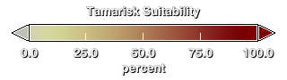
Suitability colorbar

The ISFS conducted several field surveys in Colorado. The actual location of the Tamarisk trees are shown in green.
Credits
Please give credit for this item to:
NASA/Goddard Space Flight Center
Scientific Visualization Studio
-
Animator
- Lori Perkins (NASA/GSFC)
-
Scientists
- Jeffrey Morisette (NASA/GSFC)
- Jeff Pedelty (NASA/GSFC)
Release date
This page was originally published on Wednesday, February 15, 2006.
This page was last updated on Wednesday, May 3, 2023 at 1:55 PM EDT.
Series
This visualization can be found in the following series:Datasets used in this visualization
-
[Aqua: MODIS]
ID: 5 -
[Landsat-7: ETM+]
ID: 55This dataset can be found at: http://landsat.gsfc.nasa.gov/about/wrs.html
See all pages that use this dataset -
[NOAA: AVHRR]
ID: 74 -
[Terra: MODIS]
ID: 116
Note: While we identify the data sets used in these visualizations, we do not store any further details, nor the data sets themselves on our site.