National Map Showing Habitat Suitability for Tamarisk Invasion
The spread of invasive species is one of the most daunting environmental, economic, and human-health problems facing the United States and the World today. It is one of several grand challenge environmental problems being addressed by NASA's Science Mission Directorate through a national application partnership with the US Geological Survey. NASA and USGS are working together to develop a National Invasive Species Forecasting System (ISFS) for the management and control of invasive species on Department of Interior and adjacent lands. The system provides a framework for using USGS's early detection and monitoring protocols and predictive models to process MODIS, ETM+, ASTER and commercial remote sensing data, to create on-demand, regional-scale assessments of invasive species likely habitats.
Recent work on the Invasive Species Forecasting System (ISFS) project has shown the importance of remotely-sensed time-series data in geostatistical models for mapping the distribution of Tamarisk and other invasive plant species. This video shows the habitat suitability for a Tamarisk invasion in the continental United States. Red indicates areas that are highly suitable and yellow indicates areas which are less suitable. Texas, New Mexico, and Nevada are the most highly suitable states. Utah and Arizona have the next greatest risk. California, Arizona, Montana, Colorado, Oregon, Ohio, Wyoming, and Florida also have a significant risk.
National map produced in August 2005 showing habitat suitability for tamarisk invasion. The states that have the most suitable habitat for Tamarisk are highlighted.
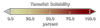
Suitability Colorbar

National map produced in August 2005 showing habitat suitability for tamarisk invasion.
The three states with the highest percentage of 'Highly Suitable' habitat areas are Texas at 30.11%, New Mexico at 13.55% and Nevada at 12.97%.
Here are the states which have more than 1% of the state's total area classified as 'Highly Suitable'. The states with the most risk are Texas ( 30.11%), New Mexico ( 13.55%), Nevada ( 12.97%), Utah ( 8.34%), and Arizona (8.24%).
Credits
Please give credit for this item to:
NASA/Goddard Space Flight Center
Scientific Visualization Studio
-
Animator
- Lori Perkins (NASA/GSFC)
-
Scientists
- Jeffrey Morisette (NASA/GSFC)
- Jeff Pedelty (NASA/GSFC)
Release date
This page was originally published on Wednesday, February 15, 2006.
This page was last updated on Wednesday, May 3, 2023 at 1:55 PM EDT.
Series
This visualization can be found in the following series:Papers used in this visualization
http://www.nasa.gov/home/hqnews/2006/feb/HQ_06063_Invasive_species.html
Datasets used in this visualization
-
[Aqua: MODIS]
ID: 5 -
[Landsat-7: ETM+]
ID: 55This dataset can be found at: http://landsat.gsfc.nasa.gov/about/wrs.html
See all pages that use this dataset -
[NOAA: AVHRR]
ID: 74 -
[Terra: MODIS]
ID: 116
Note: While we identify the data sets used in these visualizations, we do not store any further details, nor the data sets themselves on our site.