Monthly Cloud Fraction (Terra/MODIS)
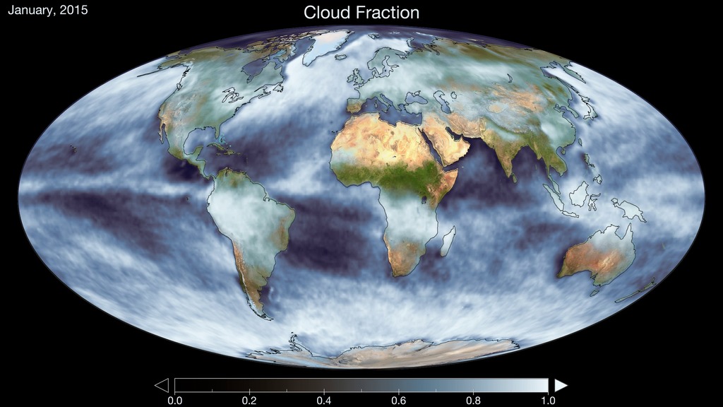
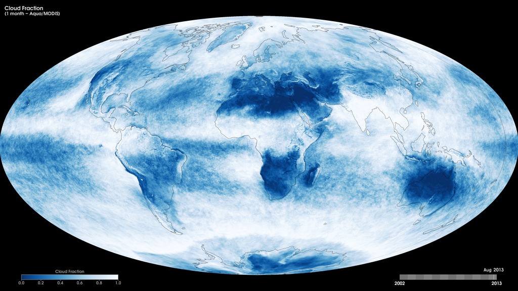
Cloud fraction is the measurement scientists use to determine how much of the Earth is covered by clouds. The measurement is important because clouds play a large role in regulating the amount of energy that reaches the Earth from the sun as well as the amount of energy that the Earth reflects and emits back into space. These maps show monthly cloud fraction from January 2005 to the present, produced using data from the Moderate Resolution Imaging Spectroradiometer (MODIS) instrument onboard NASA’s Terra satellite. Like a digital camera, MODIS collects information in gridded boxes or pixels. Each box covers one square kilometer. Cloud fraction is the portion of each pixel that is covered by clouds. Scientists make this measurement by counting the number of pixels in a 25-square-kilometer box (5 pixels tall by 5 pixels wide) that are cloudy and dividing that number by 25. Scientists use these measurements to better understand how much of the Earth is covered by clouds and how changes in Earth’s climate may alter the amount and types of clouds that form.
Monthly Terra/MODIS cloud fraction, January 2005 to the present.
For More Information
Credits
Based on imagery by Reto Stockli, NASA's Earth Observatory, using data provided by the MODIS Atmosphere Science Team, NASA Goddard Space Flight Center.
-
Visualizers
- Marit Jentoft-Nilsen (Global Science and Technology, Inc.)
- Reto Stockli (NASA/GSFC)
Missions
This page is related to the following missions:Series
This page can be found in the following series:Datasets used
-
[Terra: MODIS]
ID: 116
Note: While we identify the data sets used on this page, we do not store any further details, nor the data sets themselves on our site.
Related
- ID: 30839
 Hyperwall Visual
 - ID: 30397
 Hyperwall Visual
Release date
This page was originally published on Thursday, October 24, 2013.
This page was last updated on Sunday, February 2, 2025 at 11:31 PM EST.