Life Returns to the Galapagos after El Niño (WMS)
During the El Niño in 1997 and 1998, the surface water in the eastern equatorial Pacific off the coast of South America was warmer than normal. This warm water trapped the ocean nutrients that normally come to the surface in the upwelling cold water, leading to a drastic decrease in phytonplankton and other ocean life in the region. The unique Galapagos ecosystem was severely affected and many species, including sea lions, seabirds, and barracudas, suffered a very high mortality level. During the second week of May, 1998, the ocean temperatures plummeted 10 degrees in one day, and the ocean productivity exploded with large phytoplankton blooms. After this time, many species recovered very rapidly and the land species started to reproduce immediately. The SeaWiFS instrument, which monitors global phytoplankton in the oceans by measuring the color of reflected light, caught this dramatic recovery. This visualization shws images from SeaWiFS starting on May 10, 1998 and ending on May 31, 1998, where ocean colors of blue or purple represents little or no ocean life and colors or yellow and red indicate significant ocean productivity. White and gray denote areas occluded by clouds in these images, and a relief image of the Galapagos Islands has been superimposed on the images to clarify the location of the islands.
SeaWiFS recorded the recovery of ocean life around the Galapagos Islands during May, 1998.
This product is available through our Web Map Service.
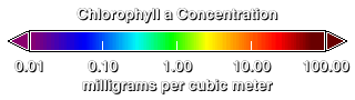
This legend shows the concentrations of chlorophyll in the ocean.
For More Information
Credits
Please give credit for this item to:
NASA/Goddard Space Flight Center, The SeaWiFS Project and GeoEye, Scientific Visualization Studio. NOTE: All SeaWiFS images and data presented on this web site are for research and educational use only. All commercial use of SeaWiFS data must be coordinated with GeoEye (NOTE: In January 2013, DigitalGlobe and GeoEye combined to become DigitalGlobe).
-
Animators
- Horace Mitchell (NASA/GSFC)
- Marte Newcombe (Global Science and Technology, Inc.)
-
Scientist
- Gene Feldman (NASA/GSFC)
Release date
This page was originally published on Friday, February 13, 2004.
This page was last updated on Wednesday, May 3, 2023 at 1:56 PM EDT.
Series
This visualization can be found in the following series:Datasets used in this visualization
-
[SeaStar: SeaWiFS]
ID: 100NOTE: All SeaWiFS images and data presented on this web site are for research and educational use only. All commercial use of SeaWiFS data must be coordinated with GeoEye
Credit: NASA/Goddard Space Flight Center, The SeaWiFS Project and GeoEye, Scientific Visualization Studio. NOTE: All SeaWiFS images and data presented on this web site are for research and educational use only. All commercial use of SeaWiFS data must be coordinated with GeoEye (NOTE: In January 2013, DigitalGlobe and GeoEye combined to become one DigitalGlobe.).
See all pages that use this dataset
Note: While we identify the data sets used in these visualizations, we do not store any further details, nor the data sets themselves on our site.