Landsat 9 Spacecraft Animations and Stills
Landsat 9 is a collaboration between NASA and the U.S. Geological Survey, and will continue the Landsat program’s critical role in monitoring, understanding and managing the land resources needed to sustain human life. The mission will provide moderate-resolution (15 meter to 100 meter, depending on spectral frequency) measurements of the Earth's terrestrial and polar regions in visible, near-infrared, short wave infrared, and thermal infrared wavelengths. There are two instruments on the spacecraft, the Thermal InfraRed Sensor 2 (TIRS-2) and the Operational Land Imager 2 (OLI-2).
Landsat 9 will provide continuity with the nearly 50-year long Landsat land imaging data set. In addition to widespread routine use for land use planning and monitoring on regional to local scales, support of disaster response and evaluations, and water use monitoring, Landsat measurements directly serve NASA research in the focus areas of climate, carbon cycle, ecosystems, water cycle, biogeochemistry, and Earth surface/interior.
The Landsat program is the only U.S. satellite system designed and operated to repeatedly observe the global land surface at a moderate scale that shows both natural and human-induced change.
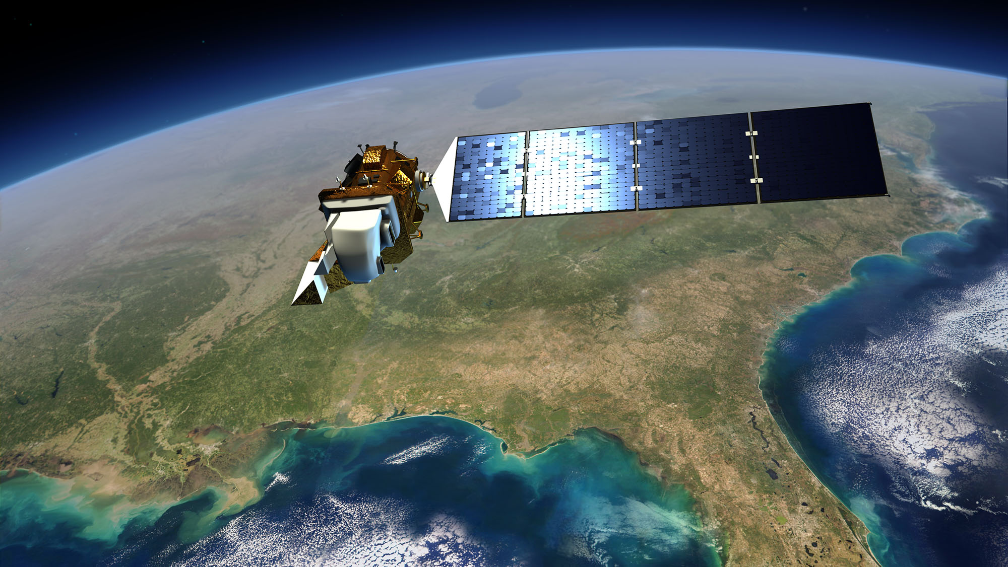
Animation of the Landsat 9 spacecraft in orbit around Earth, passing over the US from the Great Lakes to the Gulf of Mexico. The satellite will travel at 7.5 km/second, circling the globe every 99 minutes at an altitude of 705 km (438 miles). Landsat 9 will image a swath 185 km (115 miles) in width and complete about 14 orbits each day, thereby imaging every part of Earth every 16 days.
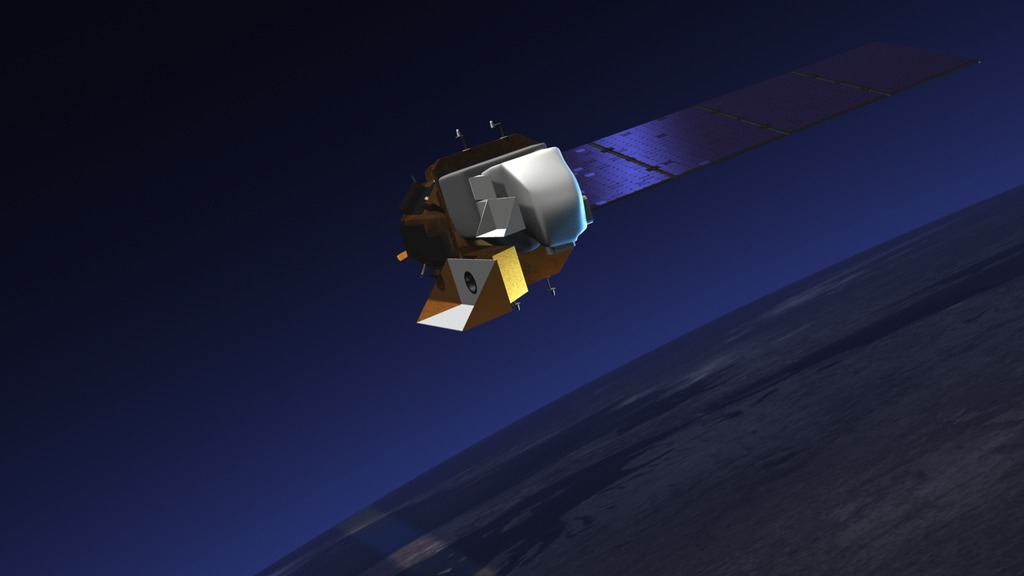
Animation of the Landsat 9 spacecraft in orbit around Earth, passing over the Western US and Baja California. The satellite will travel at 7.5 km/second, circling the globe every 99 minutes at an altitude of 705 km (438 miles). Landsat 9 will image a swath 185 km (115 miles) in width and complete about 14 orbits each day, thereby imaging every part of Earth every 16 days.
Animation of the Landsat 9 spacecraft in orbit around Earth, passing over the Mississippi Delta region in the United States of America. The satellite will travel at 7.5 km/second, circling the globe every 99 minutes at an altitude of 705 km (438 miles). Landsat 9 will image a swath 185 km (115 miles) in width and complete about 14 orbits each day, thereby imaging every part of Earth every 16 days.

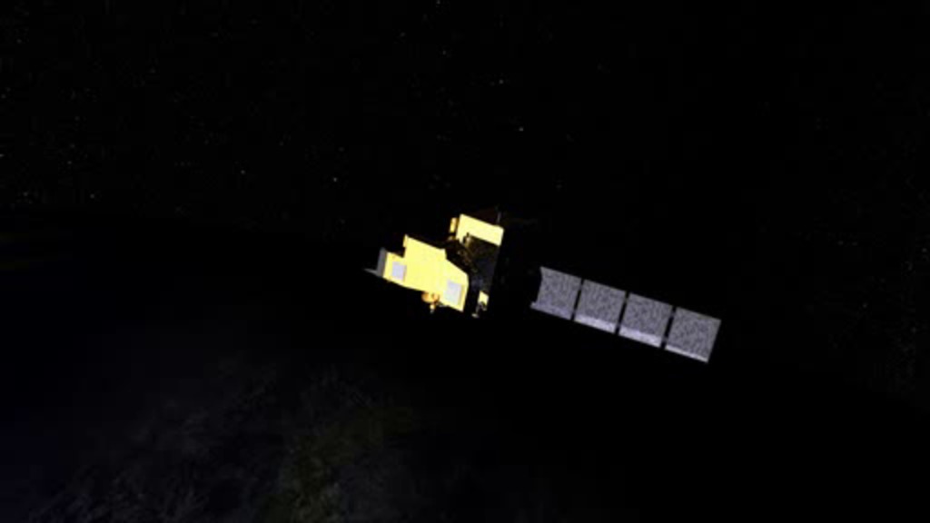
An artist's conception of the Landsat 9 spacecraft, the ninth satellite launched in the long-running Landsat program, high above the Western US.
An artist's conception of the Landsat 9 spacecraft, the ninth satellite launched in the long-running Landsat program, high above the US Gulf Coast.
An artist's conception of the Landsat 9 spacecraft, the ninth satellite launched in the long-running Landsat program, high above the agricultural fields in California's Central Valley and the Western US.
Artist's rendering of Landsat 9 from underneath, showing the ground-facing apertures of the two instruments: the Thermal Infrared Sensor 2 (TIRS-2, left) and the Operational Land Imager 2 (OLI-2, right). TIFF file has a transparent background.
Artist's rendering of Landsat 9 from above. The calibration aperture of the Thermal Infrared Sensor 2 (TIRS-2) is visible on the left side. TIFF file has a transparent background.
Artist's rendering of Landsat 9 from the front. In this view, the spacecraft is flying towards the viewer. TIFF file has a transparent background.
Wireframe model of Landsat 9
Sketch of Landsat 9
Credits
Please give credit for this item to:
NASA's Goddard Space Flight Center/Conceptual Image Lab
The Landsat Program is a series of Earth-observing satellite missions jointly managed by NASA and the U.S. Geological Survey.
-
Producer
- Matthew R. Radcliff (USRA)
-
Technical support
- Aaron E. Lepsch (ADNET Systems, Inc.)
-
Animators
- Vuk Nikolic (Freelance)
- Walt Feimer (KBR Wyle Services, LLC)
- Adriana Manrique Gutierrez (USRA)
- Ryan Fitzgibbons (KBR Wyle Services, LLC)
Release date
This page was originally published on Friday, July 26, 2019.
This page was last updated on Sunday, December 10, 2023 at 2:31 AM EST.
Missions
This visualization is related to the following missions:Related
- ID: 13920

- ID: 13292
![The Thermal Infrared Sensor 2 (TIRS-2) has passed its tests at NASA's Goddard Space Flight Center and traveled across the country to be integrated onto Landsat 9.Music: Last Outpost by Lennert Busch [PRS], published by Sound Pocket Music [PRS]Complete transcript available.Watch this video on the NASA Goddard YouTube channel.](/vis/a010000/a013200/a013292/TIRS-2_shipping_20190813-28_print.jpg) Produced Video
Produced Video - ID: 12754
 Produced Video
Older Versions
- ID: 10812
 Produced Video
 - ID: 10519
 Produced Video
Used as a Source In
- ID: 13712
 Produced Video
 - ID: 13247
![Video promoting the technological advances of Landsat 9, continuing the legacy of global land imaging begun in 1972. The video highlights the origin of the Landsat program and some of the many benefits we receive from its data.Music: Marble Place by Matias Suescun [SACEM], published by KTSA Publishing [SACEM], available from Universal Production Music Complete transcript available.Watch this video on the NASA Goddard YouTube channel.](/vis/a010000/a013200/a013247/Landsat9_teaser_20200723_youtube.00142_print.jpg) Produced Video
Produced Video