Landsat Tracks Mount St. Helens Recovery
In 1980, Mount St. Helens roared back into major activity with a massive eruption that leveled surrounding forest, blasted away over a thousand feet of the mountain's summit, and claimed 57 human lives.
This short video shows the catastrophic eruption - and the amazing recovery of the surrounding ecosystem - through the eyes of the Landsat satellites, which have been imaging our planet for almost forty years.
By observing red, near-infrared, and green wavelengths of light reflected off the surface, it is possible to distinguish healthy vegetation (in green) from bare ground (in magenta).
Music: Running by Dirk Ehlert [BMI], Guillermo De La Barreda [BMI]
Watch this video on the NASA Goddard YouTube channel.
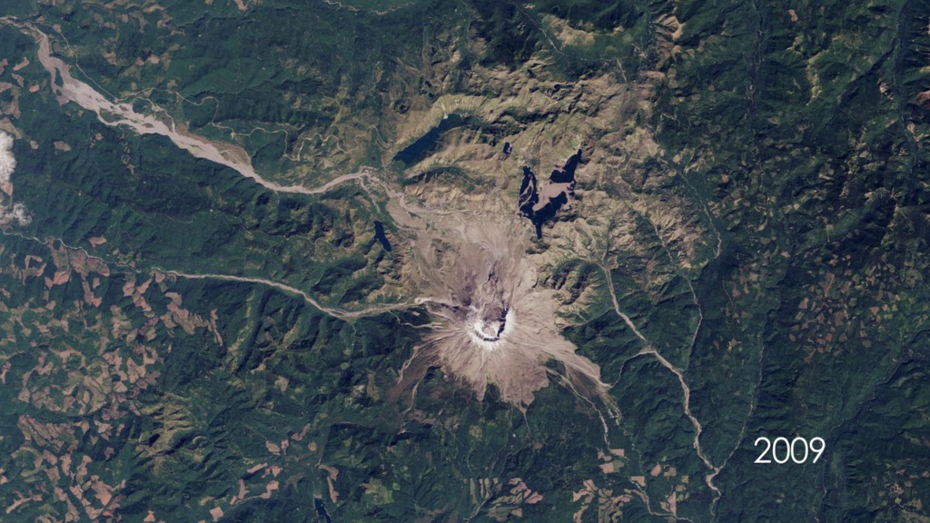
The May 18, 1980, eruption of Mount St. Helens came after two months of small earthquakes. During the eruption, an avalanche of debris and mud spread for miles from the former summit, and a blast of steam and hot ash covered an area of about 600 square kilometers (230 square miles).
In the decades since, scientists have studied the recovery of the ecosystem around the mountain using the Landsat series of satellites. By observing different wavelengths of light reflected of the surface, Landsat data can identify different types of landcover. This visualization uses red, near-infrared, and green to distinguish healthy vegetation (green) from bare ground (magenta).
NASA and the U.S. Department of the Interior through the U.S. Geological Survey (USGS) jointly manage Landsat, and the USGS preserves a 40-plus-year archive of Landsat images that is freely available over the Internet. Since the launch of Landsat 1 in 1972, Landsat satellites have become an integral part of many operational land management activities. Landsat satellites provide decision makers with key information about the world’s food, forests, water and how these and other land resources are being used.
The USGS has detailed information on the geology of Mount St. Helens.
For More Information
Credits
Please give credit for this item to:
NASA's Goddard Space Flight Center
-
Producer
- Matthew R. Radcliff (USRA)
Release date
This page was originally published on Thursday, May 18, 2017.
This page was last updated on Wednesday, May 3, 2023 at 1:47 PM EDT.
Missions
This visualization is related to the following missions:Series
This visualization can be found in the following series:Older Versions
- ID: 10550
 Produced Video