NASA On Air: NASA Scientists Helping To Track Dangerous Volcanic Ash Plumes (5/17/2016)
LEAD: NASA scientists are developing new ways to map and forecast the ash plumes from volcano eruptions and redirect aircraft from dangerous plumes.
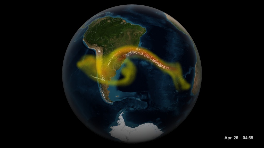
1. The small volcanic ash particles are especially dangerous to the jet engines of airplanes.
2. Because only volcanic clouds contain significant abundances of SO2 (sulfur dioxide) the Suomi NPP satellite (launched in 2011) is able to track the volcanic plumes.
3. The high-resolution vertical profiles will allow more accurate forecasts and help reduce airline cancellations and re-routing costs.
TAG: This capability of three-dimensional mapping of a moving volcanic cloud has never been done before.
Credits
Please give credit for this item to:
NASA's Goddard Space Flight Center
-
Producer
- Howard Joe Witte (ADNET Systems, Inc.)
-
Video editor
- Sophia Roberts (USRA)
-
Technical support
- Aaron E. Lepsch (ADNET Systems, Inc.)
Release date
This page was originally published on Tuesday, May 17, 2016.
This page was last updated on Wednesday, May 3, 2023 at 1:48 PM EDT.
Missions
This visualization is related to the following missions:Related
- ID: 12221
 Produced Video