Mapping Earth's Gravity
Of the terrestrial planets in the solar system, Earth is not only the largest body but also the most massive. A calculation of its weight puts it slightly over 6.58 sextillion tons (that's 6.58x10^21 or 6,580,000,000,000,000,000,000). It's heavy because everything on our planet has mass—from the land that covers the continents to the water that fills the oceans. Earth's mass, however, isn't distributed evenly. Varying surface topography and the continuous movement of water cause different parts of the globe to have more or less mass than other regions. Since 2002, NASA's twin GRACE satellites have mapped Earth's gravity (the attractive force exerted by its mass), enabling scientists to see these differences and monitor how they change over time. Watch the visualization for a tour of Earth's gravity field.

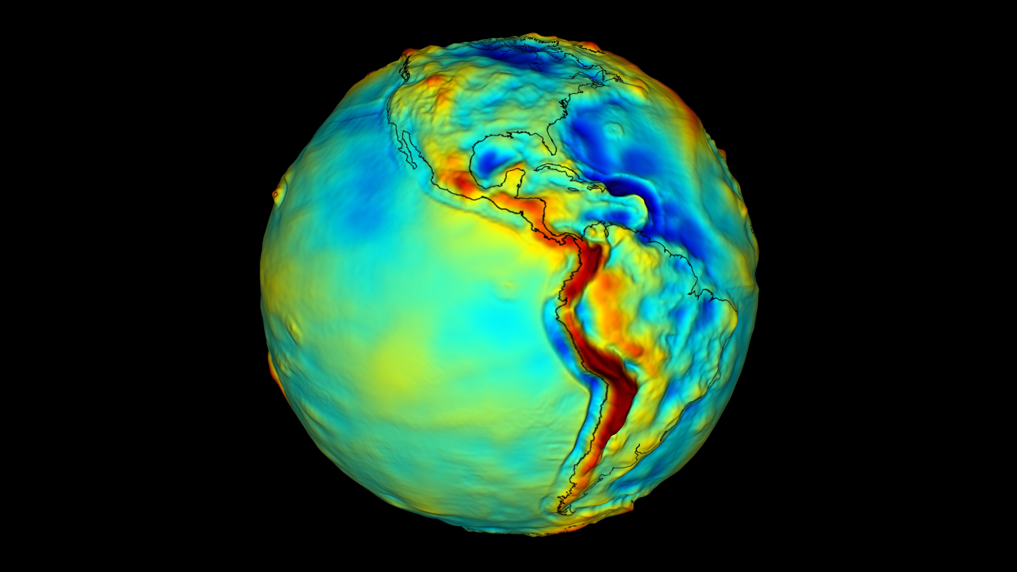
Satellite measurements offer scientists a new view of our planet.
Warm colors (red, orange, yellow) represent areas with strong gravity. Cool colors (green, blue) represent areas with weak gravity.
Mountain ranges, such as the Himalayas, have a high concentration of mass, and therefore have a strong gravity field.
Ocean trenches, such as the Mariana Trench, have a low concentration of mass, and therefore have a weak gravity field.
Undersea mountains that line this section of the Mid-Atlantic Ridge contribute to the strong gravity field observed in this region.
Credits
Please give credit for this item to:
NASA's Goddard Space Flight Center
-
Animator
- Adam Martin (UMBC)
-
Producer
- Paul Reddish (Free Spirit Films)
-
Scientists
- John C. Ries (University of Texas)
- Scott Luthcke (NASA/GSFC)
-
Writer
- Kayvon Sharghi (USRA)
Release date
This page was originally published on Tuesday, April 23, 2013.
This page was last updated on Wednesday, May 3, 2023 at 1:52 PM EDT.
Related
- ID: 3655
 Visualization