Let It Snow
Seasonal snow cover, the cold mantle that wraps up to 40 percent of the land surface in the Northern Hemisphere during winter, does more than cause rejoicing for those who dream of a White Christmas. Snow plays a key role in the Earth's energy balance, reflecting most of the sunlight that reaches its surface back to space, preventing warming of the ground beneath. Snow also absorbs energy from the atmosphere during spring melt, keeping temperatures moderate. Satellite measurements of snow extent began in the 1960s, and this lengthy record shows a 10 percent decline in annual snow cover since 1966, mainly due to earlier spring melting. Darker, snow-free ground absorbs more solar radiation and emits more warmth to the atmosphere. The snow cover loss is also a concern for those who depend on snowmelt for drinking water. Watch the visualizations below, based on data from NASA's MODIS instrument, to see the dramatic variation in a year of Earth's snow cover. In the Northern Hemisphere, the first flakes fall in mid-September over Siberia and Alaska. By the end of February, snow cover starts its retreat northward. Antarctica is home to most of the Southern Hemisphere's snow, except for some white-capped peaks and seasonal mountain snowfall in South America and Africa.

The advance-and-retreat cycle of snow cover drastically changes the whiteness and brightness of Earth.
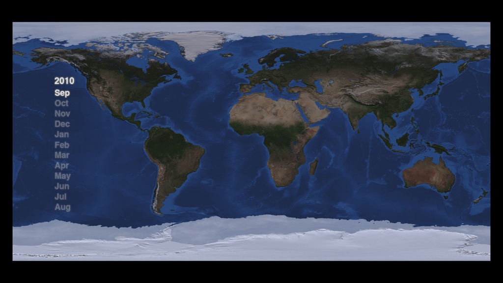
Seasonal snow cover waxes and wanes across the globe from Sept. 2010 to Aug. 2011.
At the height of winter in North America snow cover can stretch from the Arctic Circle to the southeastern United States.
The difference in the Northern Hemisphere's minimum and maximum snow cover drastically alters the reflectivity of the Earth.
Heavy snow cover blanketed the U.S. from the Great Lakes to the Deep South on Feb. 11, 2011.
A massive snowstorm covered much of continental Europe and the United Kingdom on Dec. 29, 2010.
The Himalayan and Tian Shan mountain ranges, as well as much of Siberia, had a heavy coat of snow on Feb. 28, 2010.
NASA scientists use satellite data to produce daily snow cover maps. One of their biggest hurdles: distinguishing between white clouds and snow.
This mostly cloud-covered map from the MODIS Snow & Sea Ice Global Mapping Project shows snow cover from the same day as the previous image.
For More Information
See NASA.gov
Credits
Please give credit for this item to:
NASA's Goddard Space Flight Center
Images courtesy of Dorothy Hall (NASA GSFC) and Jeff Miller(NASA GSFC/Wyle Information Systems)
-
Animators
- Helen-Nicole Kostis (USRA)
- Cindy Starr (Global Science and Technology, Inc.)
-
Scientist
- Thorsten Markus (NASA/GSFC)
-
Writers
- Maria-Jose Vinas Garcia (Telophase)
- Patrick Lynch (Wyle Information Systems)
- Adam P Voiland (Wyle Information Systems)
Release date
This page was originally published on Tuesday, December 27, 2011.
This page was last updated on Wednesday, May 3, 2023 at 1:53 PM EDT.
Sources
- ID: 3899
 Visualization