West Antarctica's Weak Spot
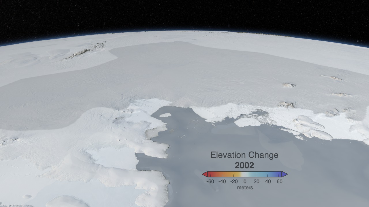
Pine Island Glacier was first called the "weak underbelly" of the West Antarctic Ice Sheet almost 30 years ago. The nickname stuck in glaciology circles because scientists still fear it is true. Pine Island, or PIG, as it's often called, drains about 10 percent of the entire West Antarctic Ice Sheet. In 2006, the glacier began losing ice mass at an even faster rate than it had before. For scientists concerned with how much PIG could contribute to sea level rise if it lives up to its moniker, there are two key questions. First, why is it changing? Scientists are investigating, among other causes, how the circulation of warming waters under the ice shelf could lead to thinning. Second, how much is it changing? Following the end of the laser altimetry mission ICESat in 2009, NASA launched an airborne campaign called Operation IceBridge to measure critical polar regions. A laser altimeter onboard NASA's DC-8 research airplane has observed PIG continuing the rapid ice loss—measured as a change in elevation—that began to accelerate in 2006. Watch in the visualization below, an analysis partly based on satellite and aircraft data, how NASA has charted PIG's increasing changes.

NASA has put an airborne mission in the field that will continue critical measurements of a worrisome glacier.
Pine Island, at left, and Thwaites glaciers have recently averaged ice elevation losses of 6 meters per year in places.
The PIG ice flow was fast in the mid-1990s but drastically accelerated about a decade later.
By 2008 the primary stream of the glacier moved at 4,000 meters per year, making it one of the fastest in the world.
The dark orange areas over West Antarctica warmed the most from 1957-2006.
During an Oct. 26, 2011 science flight, NASA's DC-8 flew over a rift opening up across the PIG ice shelf.
Scientists expect the crack to propagate across the shelf and calve an iceberg the size of New York City in the coming months.
For More Information
See NASA.gov
Credits
Please give credit for this item to:
NASA's Goddard Space Flight Center
Photograph of Pine Island Glacier ice shelf crack courtesy of NASA/GSFC/Jefferson Beck
Photograph of Pine Island Glacier ice shelf crack courtesy of NASA's Digital Mapping System team
-
Animator
- Cindy Starr (Global Science and Technology, Inc.)
-
Producer
- Jefferson Beck (USRA)
-
Scientist
- Benjamin E. Smith (University of Washington Applied Physics Lab Polar Science Center)
-
Project support
- James W. Williams (Global Science and Technology, Inc.)
- Shiloh Heurich (Global Science and Technology, Inc.)
-
Writer
- Patrick Lynch (Wyle Information Systems)
Release date
This page was originally published on Tuesday, November 8, 2011.
This page was last updated on Wednesday, May 3, 2023 at 1:53 PM EDT.
Related
- ID: 3875
 Visualization