Intro to LIDAR 3D
Want to know the 3D shape of terrain on another planet? Want to study the height and density of Earth's forests? An amazing tool called LIDAR can help. Learn more in this video!
This video is presented in stereoscopic 3D for those who can view it. We've included left and right eye clips, a side-by-side version, and an anaglyph (red/blue) version. Download any of them below!
LEFT EYE/STANDARD 2D: This version is the left eye for stereoscopic 3D presentations. You can also download this video for standard 2D presentations!
For complete transcript, click here.
RIGHT EYE: This version is the right eye for stereoscopic 3D presentations.
SIDE-BY-SIDE: This version is rendered in the side-by-side format used by some stereoscopic 3D displays.
ANAGLYPH (RED/BLUE): This version is in anaglyph (red/blue) and can be viewed in 3D using common red/blue 3D glasses. You may have a pair lying around at home!

FRAMES: Left and right eye frames and associated audio file. This is for 3D systems that play back framesets rather than video files.
This animation depicts using LIDAR to count craters on the moon.
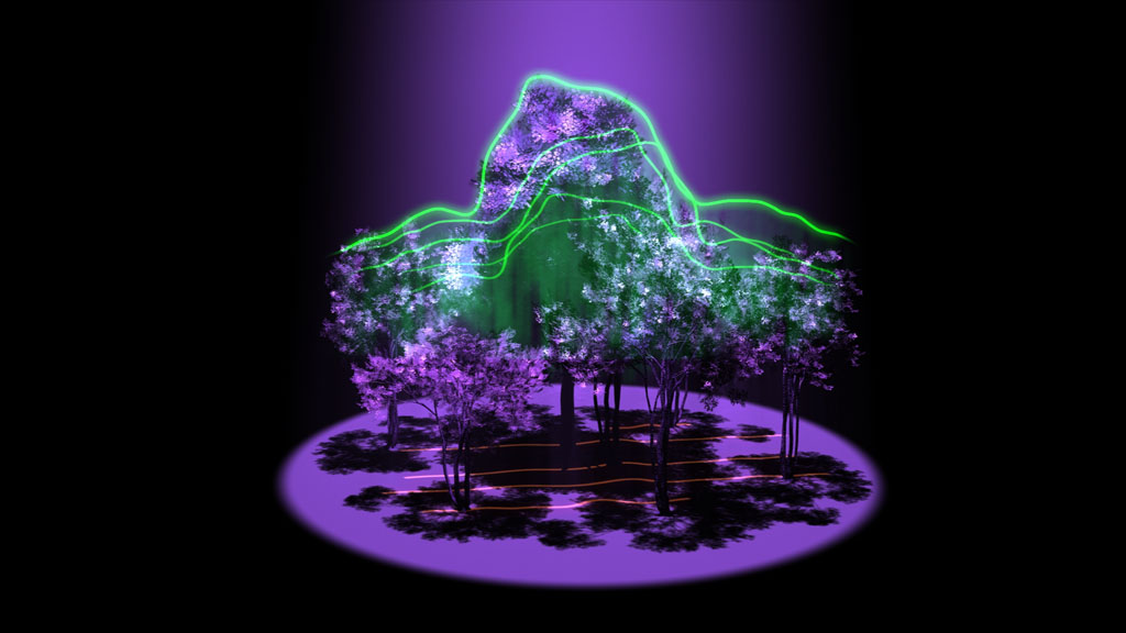
Animation depicting using LIDAR to measure the height and density of Earth's forests.
Animation depicting using LIDAR to measure small changes in Earth's ice over time.
Animation depicting the sun rising from Earth orbit.
Animation depicting LRO's LOLA LIDAR instrument rotating against a grid background.
Animation depicting a laser pulse leaving from a LIDAR instrument onboard a satellite. The pulse hits the ground and returns to the instrument. A counter indicates the measurement of the time it took the pulse to make its trip.
Animation depicting LIDAR instrumentation onboard a satellite making multiple measurements as it passes over a landscape. A graph showing the measurements is overlaid, showing how the instrument is effectively making a "map" of the landscape from space.
Animation depicting a flyover of the Linn? Crater on the moon.
Animation depicting a zoom-in to LRO's LOLA LIDAR instrument.
Animation depicting various methods of obtaining a 3D map of the moon's surface. Methods shown include estimation of height based on shadows, stereoscopic photography, and finally, LIDAR measurement.
Animation depicting a flyover of a simulated moon surface.
Credits
Please give credit for this item to:
NASA/Goddard Space Flight Center
-
Animators
- Walt Feimer (HTSI)
- Chris Smith (HTSI)
-
Video editor
- Chris Smith (HTSI)
-
Producer
- Chris Smith (HTSI)
-
Scientist
- Gregory Neumann (Massachusetts Institute of Technology)
-
Videographer
- Rob Andreoli (Advocates in Manpower Management, Inc.)
-
Writer
- Chris Smith (HTSI)
Release date
This page was originally published on Thursday, April 14, 2011.
This page was last updated on Wednesday, May 3, 2023 at 1:53 PM EDT.
Series
This visualization can be found in the following series:Tapes
This visualization originally appeared on the following tapes:-
Intro to LIDAR
(ID: 2011043)
Thursday, April 14, 2011 at 4:00AM
Produced by - Brendan Antiochos (NASA)
Related
- ID: 10835
 Produced Video