NPP Resource Reel
The NPOESS Preparatory Project (NPP) represents a critical first step in building the next-generation weather satellite system. Goddard Space Flight Center is leading NASA's effort to launch a satellite that will carry the first of the new sensors developed for this next-generation system, previously called the National Polar-orbiting Operational Environmental Satellite System (NPOESS) and now the Joint Polar Satellite System (JPSS).
NASA Goddard TV Reporter Malissa Reyes takes us inside Vandenberg Air Force Base days prior the launch of the NPP mission. Learn and see what takes place in preparation for final countdown.
For complete transcript, click here.
When it comes to a NASA mission, it is not just about the science and engineering but it is also important to educate the public about the program. In this video television crews work night and day to make sure that the audience is well informed and up to date on mission events.
For complete transcript, click here.
Final Preparations for NPP Launch (Video File) - a collection of raw interviews, animations, visualizations, and footage of the NPP spacecraft, the Delta II launch vehicle, and the science behind the project.
A fun interactive mission overview video featuring TV meteorologists Topper Shutt (WUSA9), Veronica Johnson (NBC4) and Justin Berk (ABC2). Learn about the two key messages of the NPP mission!
For complete transcript, click here.
The NPP satellite has 5 instruments on board: VIIRS, CERES, CrIS, ATMS, and OMPS. Each one will deliver a specific set of data helping weather prediction and climate studies. This video is a quick overview of each instrument and its placement on the spacecraft done at the Ball Aerospace clean room by the NPP Systems Engineer Rob Baltrum.
For complete transcript, click here.
NPP is carrying five instruments on board. The biggest and most important instrument is The Visible/Infrared Imager Radiometer Suite or VIIRS. This video focuses on VIIRS and why it is so important to Earth's science.
For complete transcript, click here.
This video talks about the importance of the Ozone Mapper Profiler Suite (OMPS), flying on board NPP. OMPS is critical for measuring the health of the stratospheric ozone.
For complete transcript, click here.
NPP is a continuation of the existing Earth-observing satellites (EOS) and it builds on the legacy of multi decades of critical data. In this video, NPP Project Scientist, James Gleason (NASA Goddard Space Flight Center), summarizes the primary messages and explains the essentials of the NPP mission.
For complete transcript, click here.
This timeline of raw footage includes best sound bytes from interviews with NASA GSFC's Chief Scientist For Atmospheres Paul Newman, Ball Aerospace's JPSS Program Manager Scott Asbury and OMPS Program Manager Joan Howard, also from Ball Aerospace.
For complete transcript, click here.
Land Discipline lead Chris Justice talks about the NPP VIRS instrument. VIIRS is the continuation of the MODIS instrument on the previous Earth-observing satellites. It will continue adding decades of data collected by Aura, Aqua, and Terra. This data will be used to help scientists predict future climate patterns.
Selected raw footage from an interview with NPP Project Scientist James Gleason at NASA Goddard Space Flight Center, Greenbelt, MD.

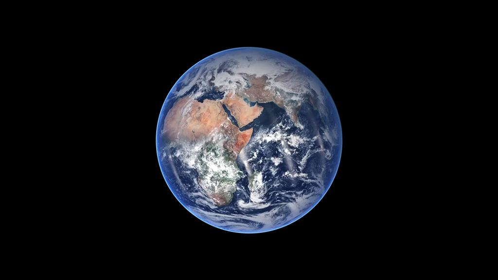
High resolution still images of the NPP spacecraft (artist rendering).
This animation is an artist rendition of the NPP polar-orbiting satellite and it shows the spacecraft looking at a hurricane.
An artist concept of the polar-orbiting NPP spacecraft flying over the North Pole.
This animation shows the NPP satellite launching from Vandenberg Air Force Base on a Delta II rocket, followed by all stages of deployment and orbit positioning.
This animation highlights the Visible Infrared Imager Radiometer Suite (VIIRS). VIIRS is one of the five instruments on board NPP and it's a follow on to the MODIS instrument. VIIRS collects visible/infrared imagery and radiometric data. Data types include atmospheric, clouds, earth radiation budget, clear-air land/water surfaces, sea surface temperature, ocean color, and low light visible imagery.
An artist rendering highlighting the Advanced Technology Microwave Sounder (ATMS) on board NPP. ATMS provides sounding observations needed to retrieve profiles of atmospheric temperature and moisture for civilian operational weather forecasting as well as continuity of these measurements for climate monitoring purposes.
An artist rendering highlighting the Clouds and the Earth's Radiant Energy System (CERES) instrument on board NPP. The long-term CERES data set will provide a basis for scientific understanding of the mechanisms and factors such as cloud/climate feedback that determine long-term climate variations and trends.
An artist rendering highlighting The Cross-track Infrared Sounder (CrIS) on board NPP. CrIS will produce high-resolution, three-dimensional temperature, pressure, and moisture profiles. These profiles will be used to enhance weather forecasting models, and they will facilitate both short- and long-term weather forecasting. Over longer timescales, they will help improve understanding of climate phenomena such as El Niño and La Niña.
An artist concept of the OMPS instrument on board NPP. OMPS is an advanced suite of three hyperspectral instruments, extends the 25-plus year total-ozone and ozone-profile records. These records are used by ozone-assessment researchers and policy makers to track the health of the ozone layer.
Raw NPP cleanroom b-roll footage segments
provided and shot by Ball Aerospace.
For More Information
Credits
Please give credit for this item to:
NASA/Goddard Space Flight Center
-
Animators
- Ryan Zuber (UMBC)
- Walt Feimer (HTSI)
-
Video editor
- Silvia Stoyanova (UMBC)
-
Interviewee
- James Gleason (NASA/GSFC)
-
Producer
- Silvia Stoyanova (UMBC)
-
Scientists
- James Gleason (NASA/GSFC)
- Chris Justice (University of Maryland)
- Paul Newman (NASA/GSFC)
-
Videographer
- Rob Andreoli (Advocates in Manpower Management, Inc.)
-
Writers
- Silvia Stoyanova (UMBC)
- Adam P Voiland (Wyle Information Systems)
Release date
This page was originally published on Thursday, August 25, 2011.
This page was last updated on Wednesday, May 3, 2023 at 1:53 PM EDT.
Missions
This visualization is related to the following missions:Series
This visualization can be found in the following series:Tapes
This visualization originally appeared on the following tapes:-
NPOESS Preparatory Project (NPP)
(ID: 2011042)
Tuesday, August 30, 2011 at 4:00AM -
NPP Mission Overview
(ID: 2011001)
Friday, April 22, 2011 at 4:00AM
Related
- ID: 11650
 Produced Video
 - ID: 10824
 Produced Video